
The Strait of Messina: A Timeless Challenge for Sailors
“Now when she [Charybdis] spewed it out, she seethed and swirled like a cauldron over a blazing fire,
the spray she flung on high rained down on the tops of both cliffs.
But when she swallowed the sea water down,
you could see the whole abyss of the whirlpool boiling,
and the dark rock roared all around,
and the sea floor appeared amid the foam.”
(Odyssey 12.236–243, transl. E.V. Rieu, slightly adapted)

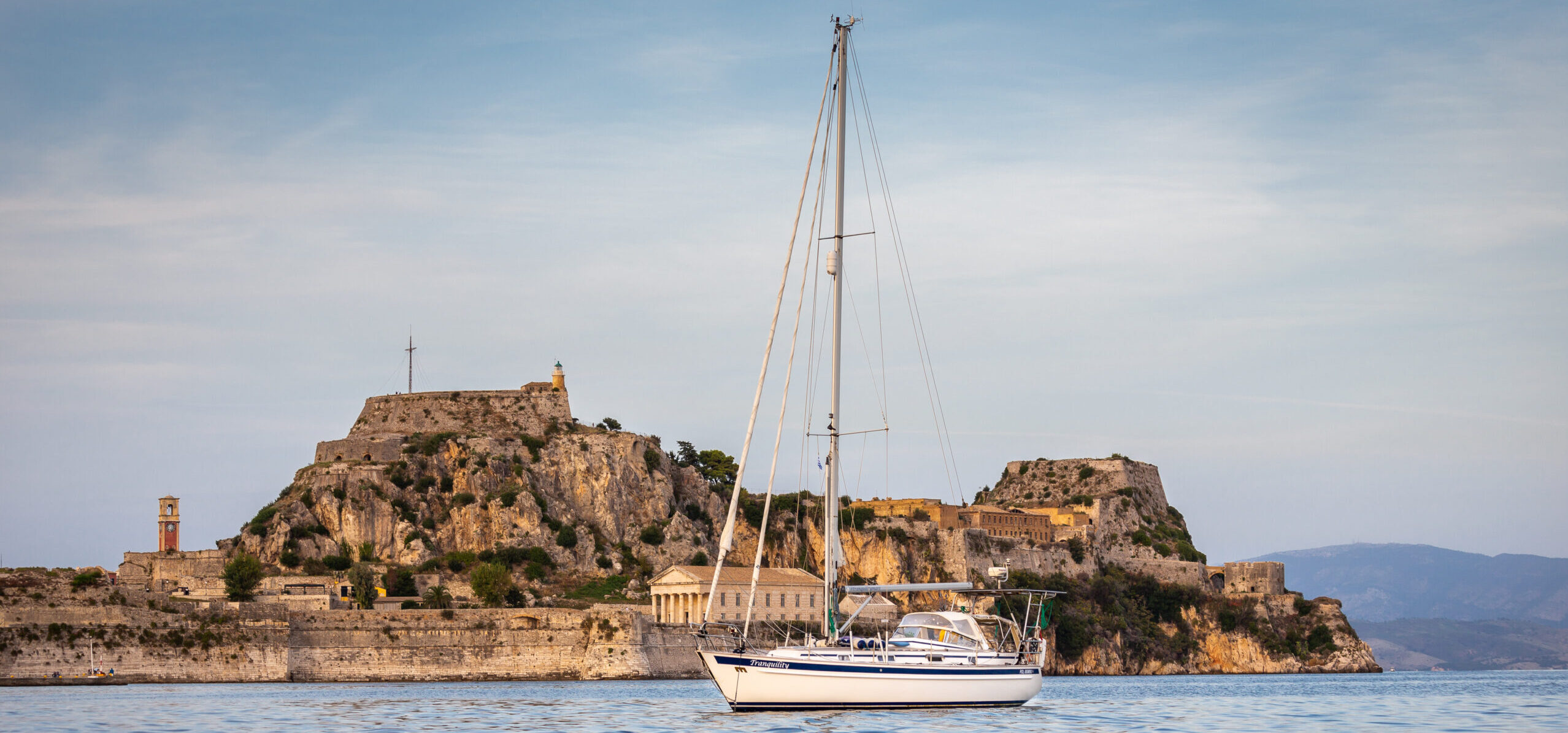
The Strait of Messina has haunted sailors since ancient times. This infamous waterway, mentioned in Homer’s Odyssey (8th century BC), is the setting for the perilous encounter with Scylla and Charybdis, mythological sea monsters said to guard its treacherous waters. Odysseus’s poetic description captures the imagination best, likening the Strait’s tumultuous waters to a cauldron boiling with intense fire.
Today, while we know there are no monsters lurking in the Strait of Messina, its challenges remain formidable. With modern scientific understanding and proper planning, we can navigate these waters safely, avoiding the fiery cauldron of myth.
This guide offers essential information about crossing the Strait of Messina, enriched with our own sailing experience. While comprehensive, we always recommend checking up-to-date resources, which we base on as well.
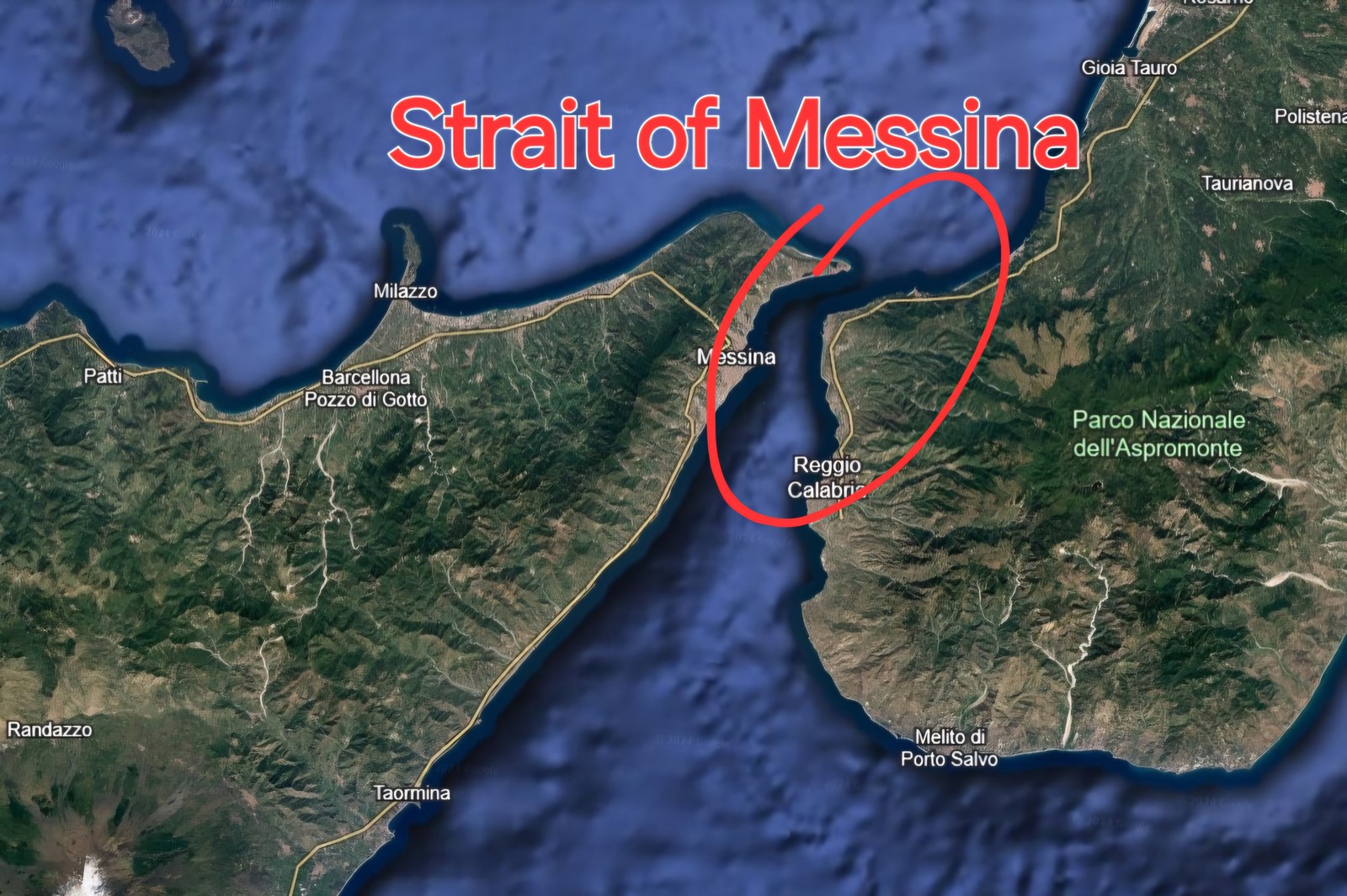
What is the Strait of Messina?
The Strait of Messina is a narrow waterway separating Sicily from mainland Italy, linking the Tyrrhenian Sea to the north with the Ionian Sea to the south. At its narrowest point, it is just 1.5 miles wide (3 km) but widens to 7.5 miles (14 km) farther south, between Capo Scaletta and Punta Pellaro. It is a heavily trafficked route for both commercial shipping and recreational sailing.
Challenges in the Strait of Messina
The Strait’s reputation for treacherous navigation comes from its currents, eddies, and whirlpools. About tides and currents you could read here, in Module 4 of our journey. On top of that, you need to take into account the wind, frequent squalls caused by mountainous terrain and, nowadays, very busy traffic.
Currents in the Strait of Messina
Tidal currents are caused by the difference in water level between the Tyrrhenian and Ionian seas. They change every 6 hours, 4 times a day. During spring tides, they can reach speeds of 4-5 knots at the narrowest point (between Punta Pezzo and Capo Peloro). As the Strait widens, the currents gradually lose their strength. In addition, the wind affects the duration and strength of the current. Winds from the opposite direction shorten the duration of the current, while a wind blowing with the current causes it to run longer and stronger. The north-going stream is called the montanate and is marked in the tables with “+”, while the current towards the south is scandente (“-”).
The montanate current begins about 1 hour and 45 minutes before the high water in Gibraltar, while the scandente about 4 hours and 30 minutes after the high water in Gibraltar. The strength and timing of currents are always forecast for the narrowest point of the Strait (Punta Pezzo). Personally, I find it fascinating that the conditions in the waters off the coast of Italy are directly influenced by the current in Gibraltar, more than 1,100 miles away.
Currents Forecast in the Strait of Messina
Nowadays, we have many tools that we can use to plan a safe passage through the Strait of Messina. Thanks to this, many of the problems of Odysseus do not apply to us.
Let us start by saying that you should use the official Tide Tables for the Strait of Messina or tools that use this data. This is not the Windy application – you will not find information about such phenomena in the “Currents” tab there.
- Website and App: Currents in the Strait of Messina
Both the website and the app are in Italian, but the automatic translation works very well. Here you will find both a graph and tables predicting the strength and direction of the currents in the narrowest point of the Strait, on both sides (Punto Pezzo on the west and Ganzirri on the east). Just select a date and you will get full information on what to expect, with data in 15-minute intervals. There is also a short instruction on how to use the table, e.g. how to adjust the time zone. - Visual Maps: Currents of the Strait
Here, the strength and direction of the currents are presented in the form of arrows on a Google map. An additional advantage is the data from more locations, not just the narrowest point in the Strait.
Whirlpools in the Strait of Messina
The whirlpools in the Strait of Messina are mainly caused by the interaction of strong tidal currents. The Strait connects two different bodies of water – the Ionian Sea and the Tyrrhenian Sea – which not only have different water levels, but also temperatures and salinity. When the currents from these seas meet in the narrow strait, they mix, creating strong turbulence in the water.
In addition, differences in the density of the water cause the heavier water from one sea to sink and the lighter water to rise to the surface, which increases turbulence even more. This water movement leads to the formation of eddies, some of which are strong enough to pose a threat to smaller vessels.
The most famous places with eddies are:
With northerly currents:
- 1. WSW of Capo Peloro off Torre Faro;
- 2. Entrance to the port of Messina and north of the entrance;
- 3. NE of Punta Pezzo.
With southerly currents:
- 1. From the fort of San Salvatore, around the port of Messina and further along the NW coast;
- 2. South of Capo Peloro;
- 3. Off Acciarello;
- 4. Between Catona and Punta Calamizzi.
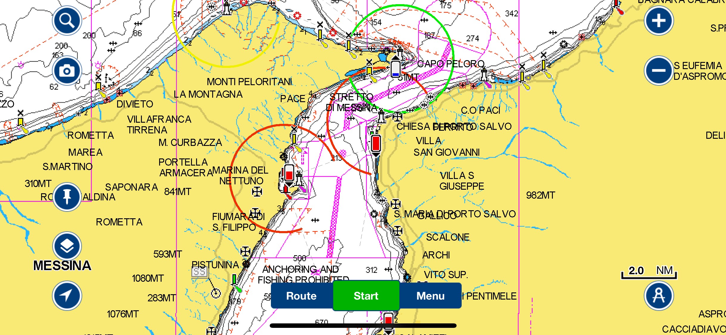
In addition, there are also local, permanent eddies. These are smaller but more concentrated eddies created by the mixing of waters of different densities from the Ionian and Tyrrhenian Seas. They can be recognized by smooth, oily spots on the water surface. The most characteristic places where they appear are:
- S of the beach of Punta San Raineri.
- 200-250 meters from Torre Faro under Capo Peloro (this is the mythological Charybdis).
- About 200 meters W of Punta Pezzo.
We highly recommend marking these locations as points on your map / chart plotter. It will make your sail much easier! I have prepared a simple map for you with these whirlpools.
Please note, that these are just approximate pins and lines, where you can encounter eddies, not the exact GPS coordinates. From our experience, the most violent and visible whirlpools are located around Torre Faro and Capo Peloro regardless the direction of currents. This is exactly where mythological Charybdis lives!
Wind Conditions in the Strait of Messina
The Strait’s topography channels winds primarily from the north or south. In the summer months, northerly winds dominate, while in spring and autumn, southerlies take precedence. In unsettled weather, the Strait often experiences violent squalls and storms, which are also intensified by the terrain.
When planning a sail through the Strait of Messina, the wind is a very important factor to take into account. Avoid sailing in conditions when the wind is opposite to the current, as this causes a dangerous, short and breaking wave. Combined with eddies, this is not the place where you would want to be.
Traffic in the Strait of Messina
The last factor to consider in the Strait of Messina is traffic. Since 2008, the Strait has been subject to a VTS – Vessel Traffic Management System. All vessels entering the Strait should contact VTS Messina on channel 16 or 10 and monitor this frequency. Don’t be surprised if nobody answers. It looks like they don’t care about small boats outside of the TSS. Small yachts under 20 m in length should stay in the coastal traffic zones. If you need to cross the TSS, there is a roundabout in the Strait of Messina for this purpose! Always inform VTS Messina of your intentions to avoid getting a fine.
Our experience in The Strait
We planned our passage through the Strait of Messina so that we would be at its narrowest point about 1.5 – 2 hours after the peak current.
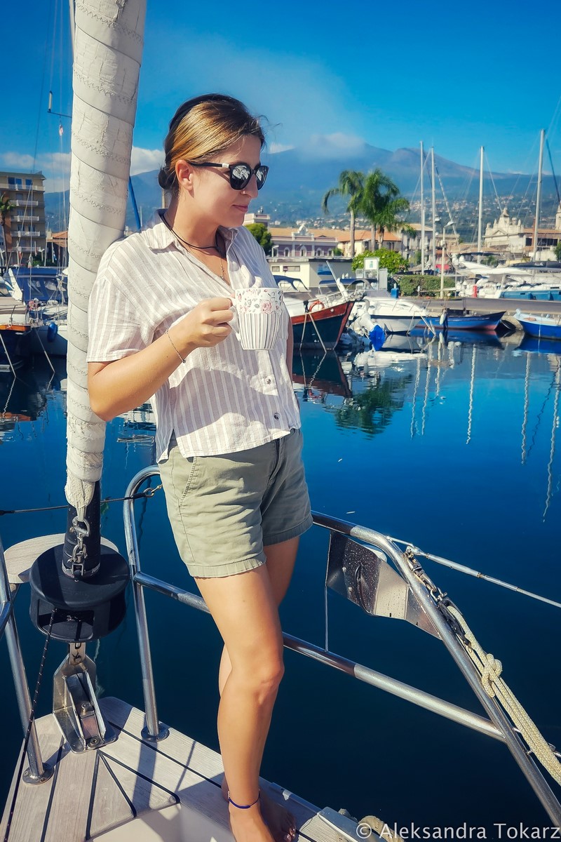
Leaving Marina di Riposto
Since we were sailing from the south, from Marina di Riposto, we chose a moment with north-going currents. In addition, we waited for light wind conditions, when the wind blows with the current.
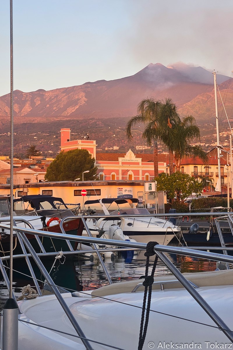
While waiting for these conditions, we highly recommend above mentioned Marina di Riposto. It was one of the most beautiful marinas we have ever been to. Smoking Etna volcano towering over the city provided us with impressing views during our stay. Additionally, the marina infrastructure and its price were quite decent.
Other marinas towards the Strait of Messina include: Messina Marina del Nettuno, Marina Reggio Calabria, Marina del Sud, Marina dello Stretto.
Crossing the Strait of Messina
On the day of our crossing, maximum current was forecast at 3 knots at 17:30 local time. By the time we reached Messina, we recorded a 1.2-knot current, which intensified as we approached the narrowest point. The water grew choppy, with visible eddies resembling smooth oil patches.
As we were approaching the narrowest point, the current began to intensify. The closer we got to the “throat”, the more rough the conditions were. The sea was getting more and more choppy, and the current was getting stronger. We clearly saw the eddies caused by the mixing of waters of different salinity. They looked like smooth oil stains on choppy water – these are places where less dense water is pushed upwards (photo in the middle below). We were constantly observing a stronger current than in the forecasts and tables. At 18:30 local time, when we were in the narrowest place of the Strait expecting about 2.4 knots of current, we recorded about 4 knots. This could have been influenced by the increasing southerly wind. Our speed relative to the ground was 9-10 knots. That’s really a lot for our yacht!
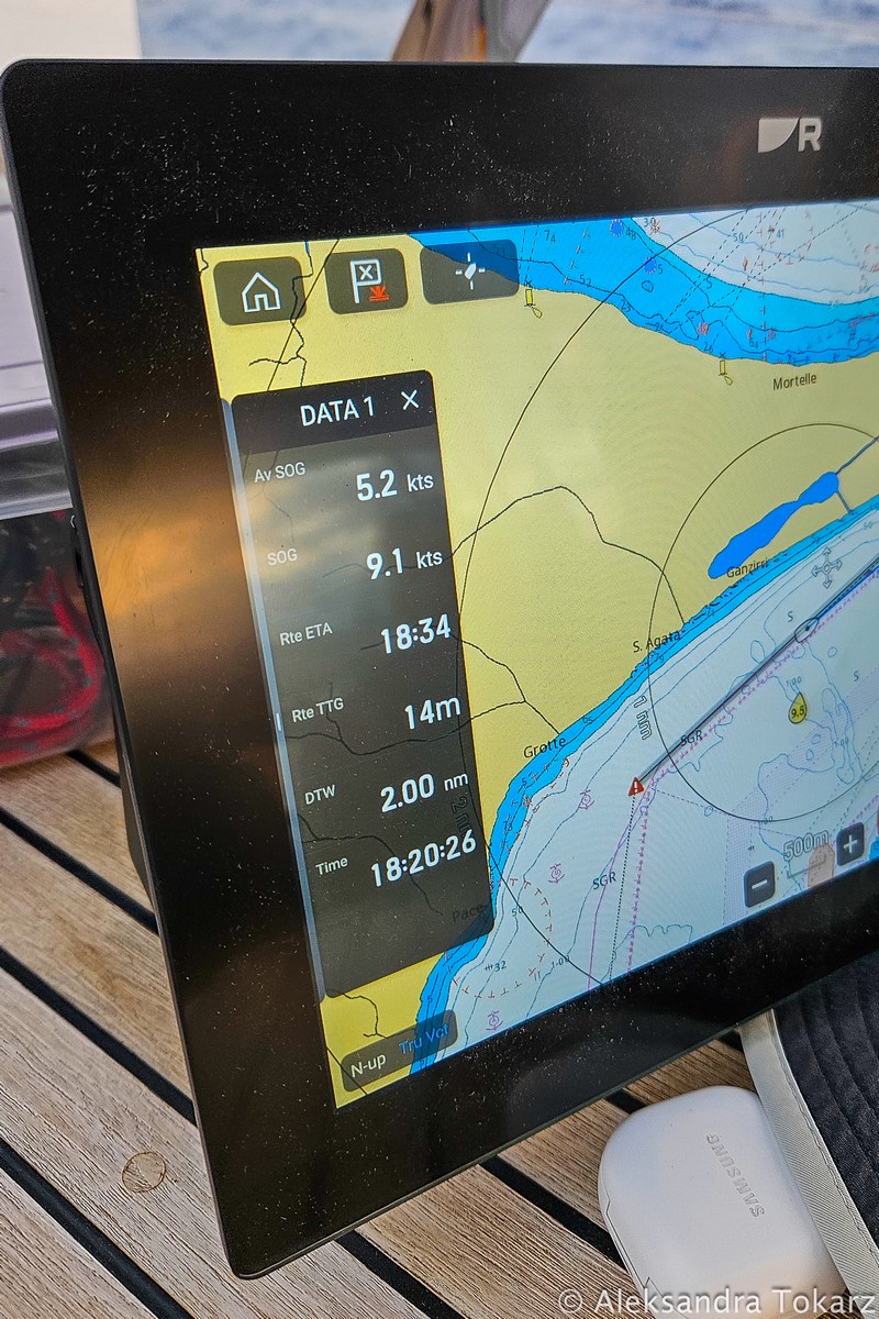
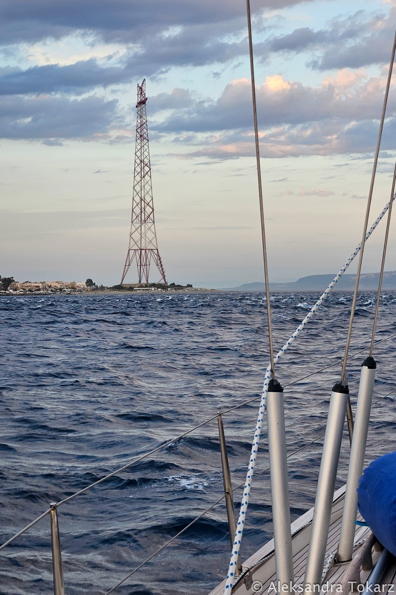
Due to the stronger currents than forecast and the increasing southerly wind, we found ourselves in the narrowest place exactly 1 hour after the strongest current, and not, as planned, 2 hours. This resulted in worse conditions in this place. We were motoring to have full maneuverability in case of a closer encounter with the mythological Charybdis.
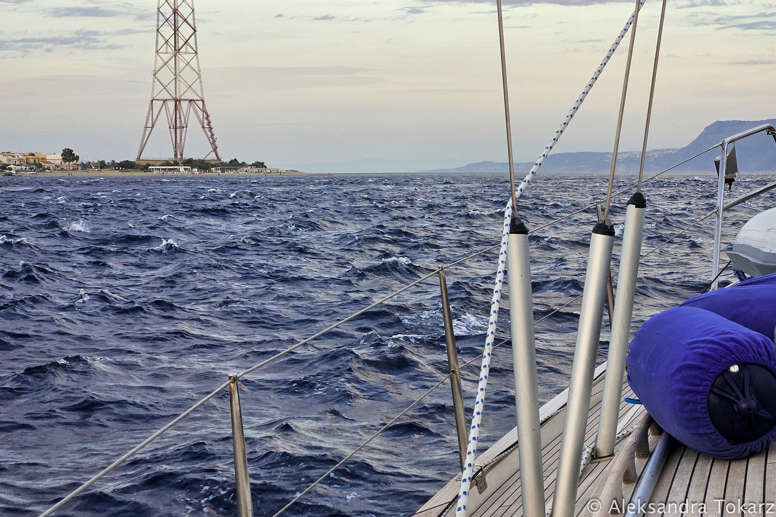
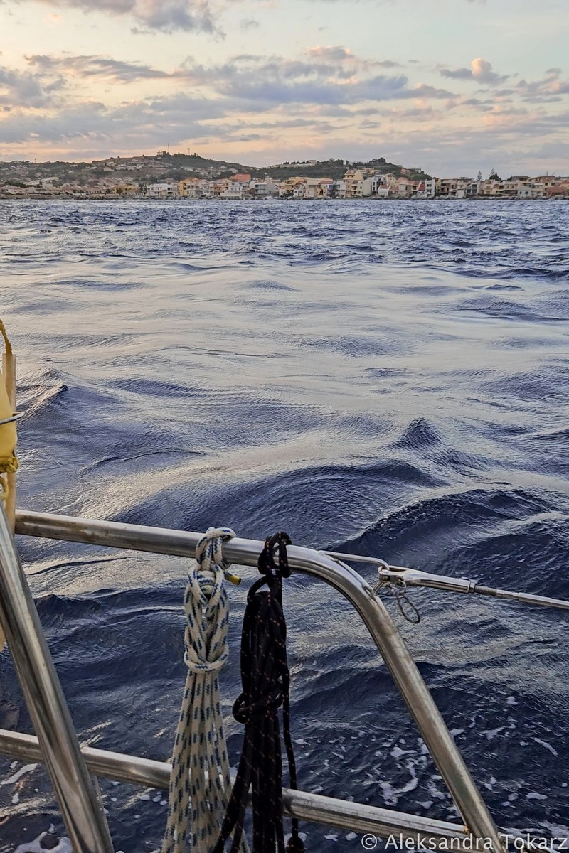
After clearing the narrowest point, the current quickly subsided, bringing smoother sailing.
Leaving the Strait of Messina
After crossing the Strait of Messina to the North, options for stopping are limited. Many crews head straight to the Aeolian Islands, about 20 miles away. We decided to spend the night at the anchorage west of the exit of the Strait at Casa Bianca and set off for the Aeolian Islands the next day. The anchorage is large and shallow, but sheltered only from winds from the south. It is a good place to spend the night, but not necessarily for a longer stopover.
Summary
Even in calm conditions, the Strait of Messina offers a fascinating and intense sailing experience. Proper preparation and understanding of its unique phenomena are essential for a safe passage. It’s no wonder that, nearly 3,000 years ago, sailors described these waters as a boiling cauldron filled with sea monsters.
Sources
If you need any help with passage planning, drop us a message!


No responses yet