The plan for the 2025 season looked simple on paper – reach Norway. In reality, though, it was going to be quite a challenge. We started the season in southern Spain, and the first part of the route meant sailing straight into the prevailing north-westerly winds that dominate Europe’s Atlantic coast in spring. Just getting to Norway meant covering more than 2,000 nautical miles, and on top of that, we planned to sail all the way back to our starting point – Almerimar.
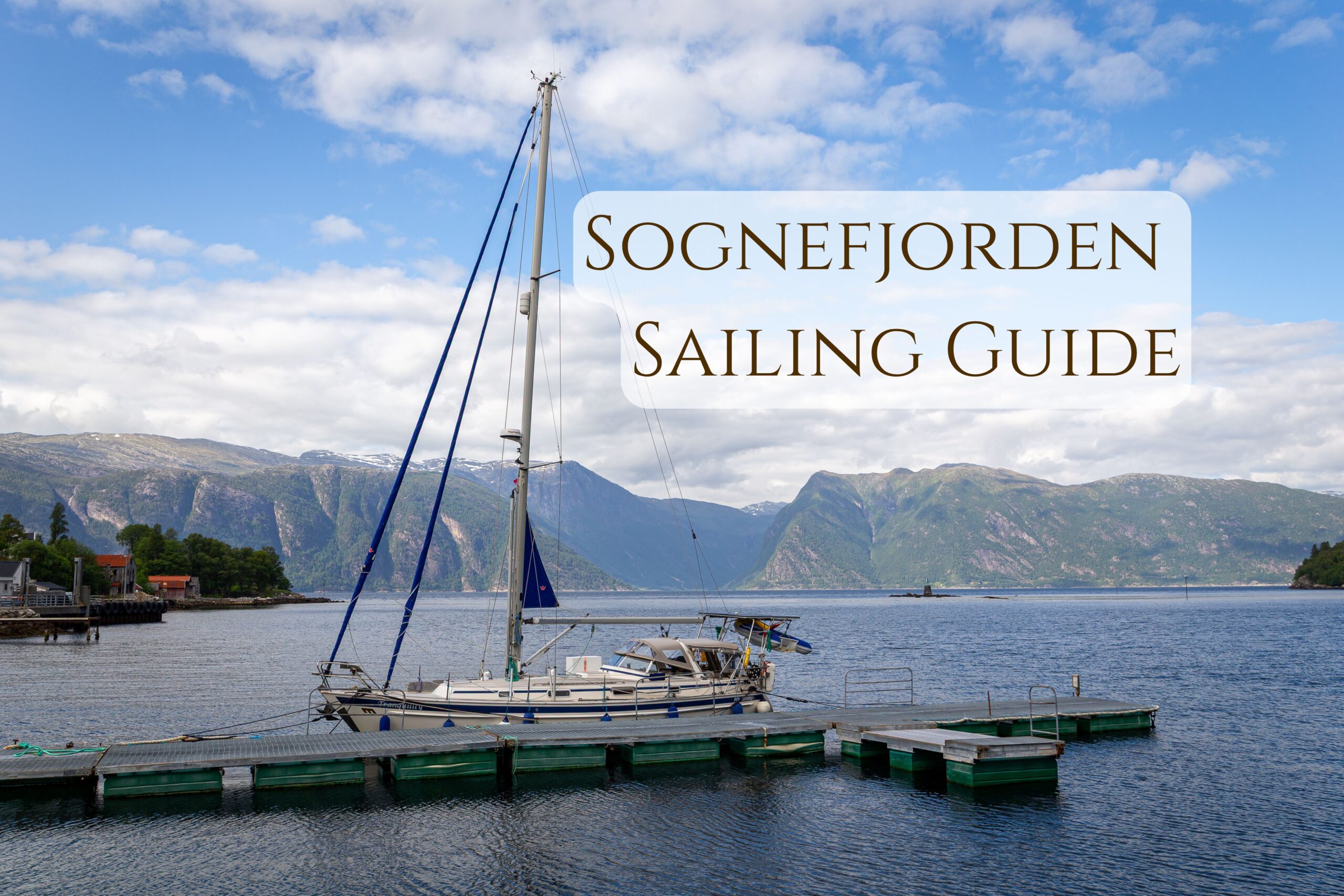
Planning the 2025 Season
Our ultimate goal was the Lofoten Islands, but we knew they were over 3,000 nautical miles from where we started. We decided not to get too attached to that idea. Once you add sightseeing, mountain hikes, and the inevitable weather delays to wait for suitable weather windows, it was obvious from the very beginning that this would be a long and demanding season.
And that’s exactly what it turned out to be. You can already find detailed accounts of both our northbound journey and the return passage on the blog:
Logbook 2025: “There”. Summary of the 2025 Sailing Season
Logbook 2025: “… and Back Again”. Summary of Sailing Season
In this post, however, we’ll focus on the main goal of our journey – Norway. We’ll tell you how we eventually gave up on our original plan of reaching the Lofoten Islands and instead spent almost two weeks exploring one of Norway’s most spectacular fjords. A place that, unlike the famous Lofoten Islands, still isn’t overrun by tourists.
Let’s go!
Why we gave up Lofoten?
The idea of not making it to Lofoten first became real while we were still in Shetland. We liked this Scottish archipelago so much that we stayed far longer than planned. Even then, we still didn’t want to leave. By the way, we also wrote a short Cruising Guide to Shetland, which you can find here.
The weather wasn’t helping either. At that time, finding a suitable weather window for crossing the Norwegian Sea wasn’t easy. Just as we were about to decide to stay in Shetland, something changed. A promising weather window appeared in the forecast. Reaching Lofoten was still possible, but it would have meant a quick dash north with almost no time to enjoy it.
That’s when another idea came up.
We had about two weeks for a trip to Norway before returning to Shetland and continuing south. So why not choose a destination a little closer? After all, Norway is much more than just Lofoten.
Why we chose Sognefjorden?
That’s how Sognefjorden ended up on our radar. It’s the longest fjord in Europe and had already made it onto our list while planning the season.
Everything suddenly made sense. The fjord was much closer than Lofoten, far less touristy, and offered fantastic hiking trails straight from the boat.
The decision was easy.
We’re going!
And looking back now, it turned out to be a very, very good decision.
Practical Information
As with every article on our blog, everything in this Sognefjord sailing guide is based on our own experience. We only write about places we have personally visited. That also means we can’t describe every harbour, bay, or marina. At the end of this article, we’ve included a list of places that looked worth visiting but that we didn’t have time to explore ourselves. You’ll find a map below showing all the places descried in this text.
Best Resources about Cruising in Norway
While planning this Sognefjord sailing trip, we used several popular sailing apps, pilot books, and, above all, the excellent Norwegian Cruising Guide. In 2026, the guide was taken over by its new publishers, the crew of Sailing Polaris, who have spent years cruising the Norwegian coast. We’re sure it will become an even better resource under their care.
How to Pay Mooring Fees in Norway?
In most places, mooring fees could be paid using a local app. Unfortunately, it required activation with a Norwegian national ID number, making it unavailable to most foreign visitors. Sometimes PayPal was offered as an alternative, but not always. Quite often, we ended up paying in the local shop, where the staff used their own app to process the payment for us.
Sailing From Shetland to Norway
Port of Entry
From the northern tip of Shetland, where we were at the time, it was about 190 nautical miles to the entrance of the fjord.
Even though we were arriving from the UK, we confirmed with the Norwegian police that we didn’t need to clear in at a Port of Entry. We both hold EU passports, and our yacht is registered in Poland. That allowed us to head straight for the smaller villages instead of stopping in a larger town to deal with formalities.
If you do need to clear into Norway, Bergen or Høyanger, further inside the fjord, are good options.
The Passage
The night was spent weaving our way between the many offshore platforms in the Norwegian Sea. A few times, we were called on the VHF and asked to keep a greater distance from the installations than the regulations actually require. That meant adding a few extra miles to the passage.
When leaving Shetland, it’s common practice to report your passage plan to Shetland Coastguard on VHF Channel 16. This way, the Coastguard has your details and can monitor your progress, making it much easier to respond if something goes wrong.
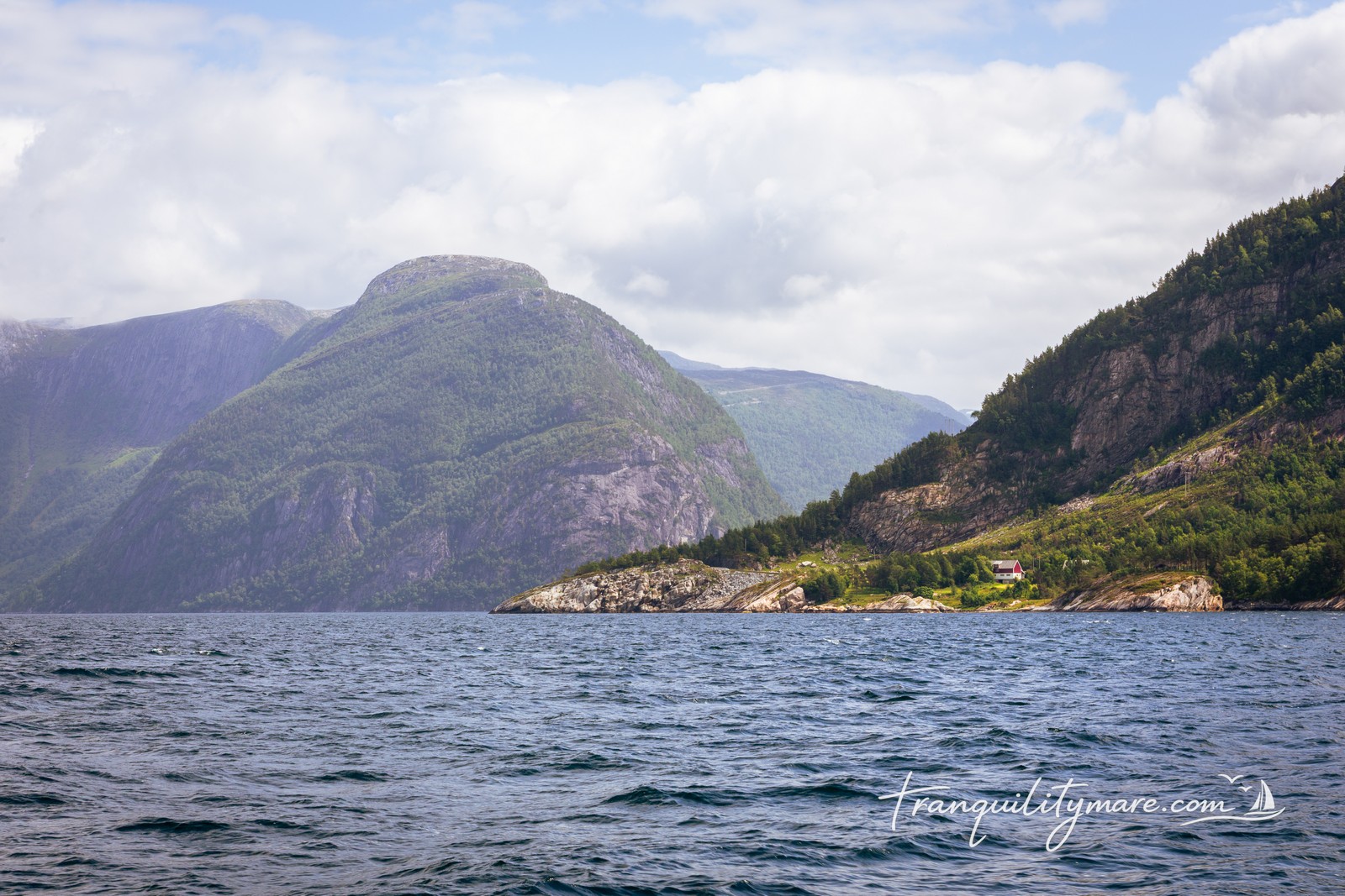
The following day, the Norwegian coast slowly appeared on the horizon. Soon after, the steep rocky mountains came into view. At that moment, we knew we had made the right decision.
Sognefjord Sailing – General Information
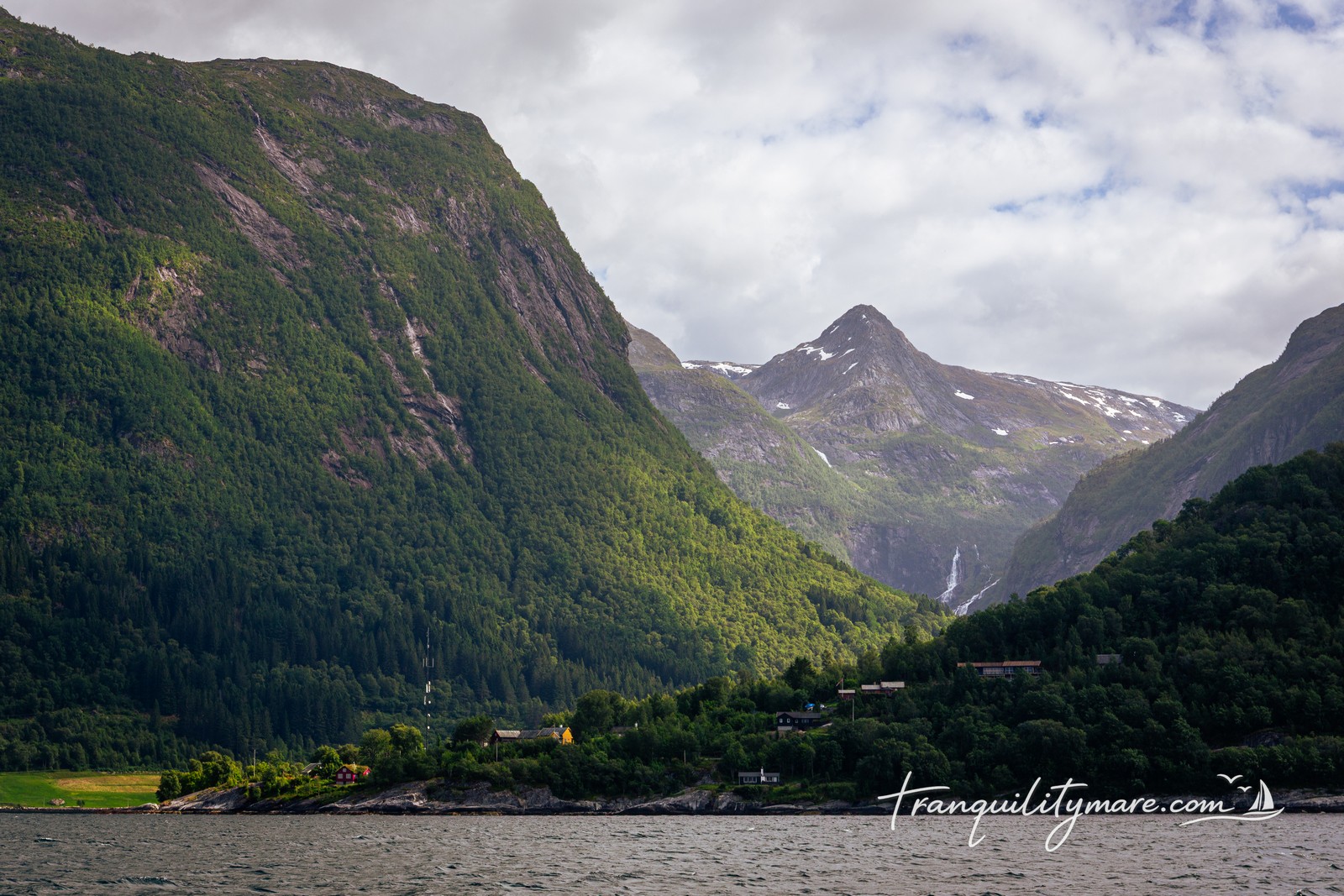
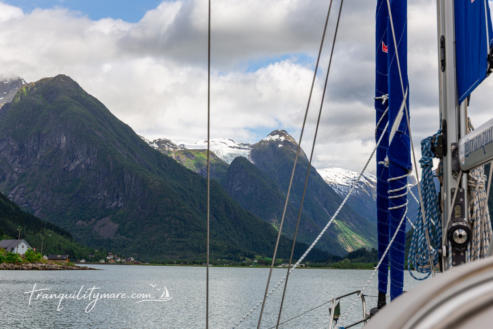
Sognefjorden is the longest fjord in Norway and Europe, and the second longest in the world. It stretches nearly 80 nautical miles inland, with some of its branches narrowing to just 250 metres across. Above its dark blue waters, which reach depths of up to 1,300 metres, rise vertical mountain walls as high as 1,400 metres. The scenery is breathtaking, and sailing deeper into the fjord is a constant reminder of why this place is so special.
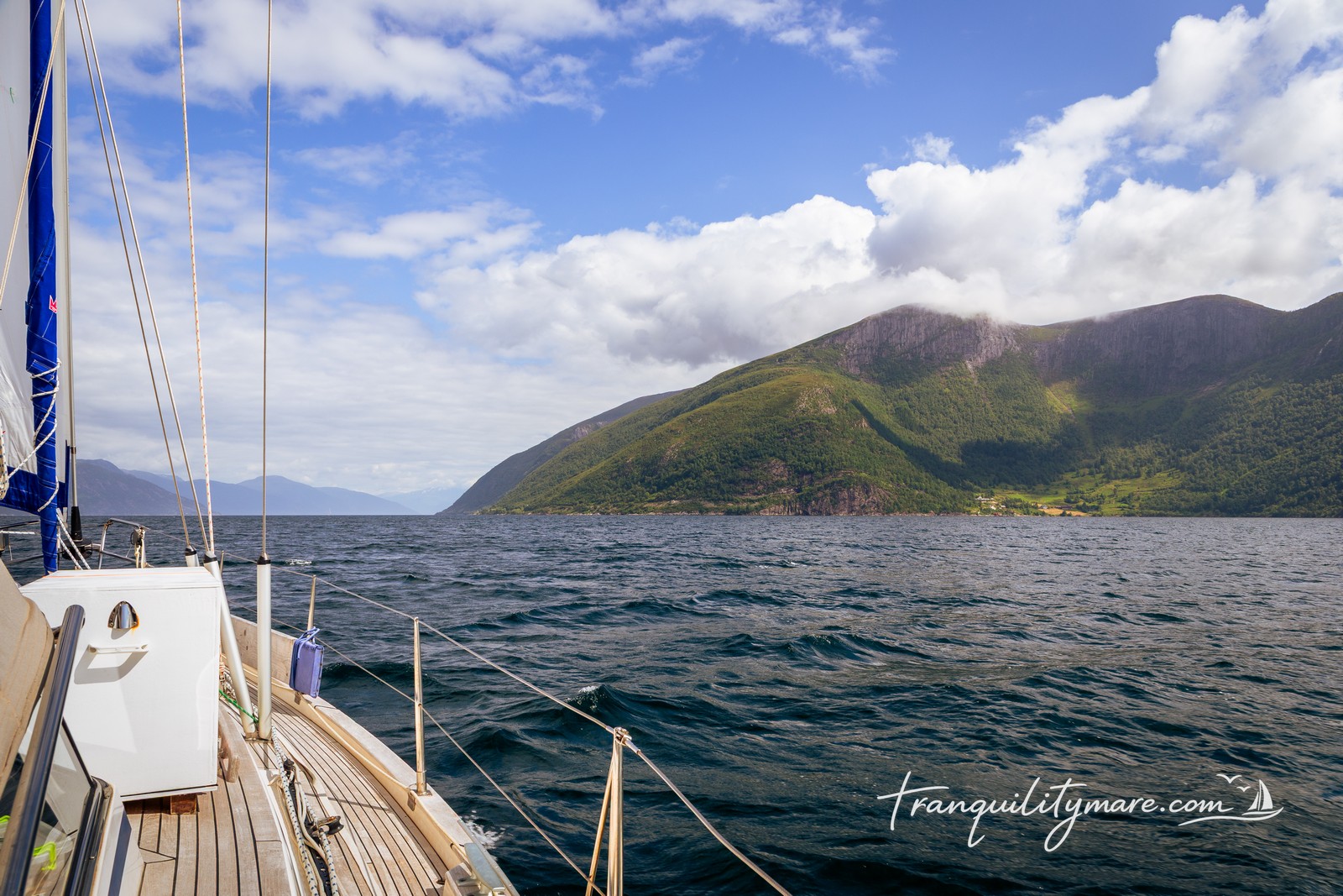
At the entrance to the fjord, you’ll pass through the scattered skerries of Sognesjøen. There are plenty of beautiful anchorages here. However, the area can become very rough in strong westerly or north-westerly winds.
Navigation inside the fjord is straightforward, with no major hazards. Strong winds, however, can create powerful gusts and katabatic winds descending from the mountains, regardless of their direction. Just as common is the opposite problem – no wind at all. Because of that, a reliable engine is essential when cruising the Norwegian fjords.
Tidal currents heading into the fjord are barely noticeable. On the way out, especially during spring tides, they can reach up to 2.5 knots. In spring and summer, melting snow and glaciers add huge amounts of fresh water, making the current even stronger. It is usually strongest along the northern shore of the fjord.
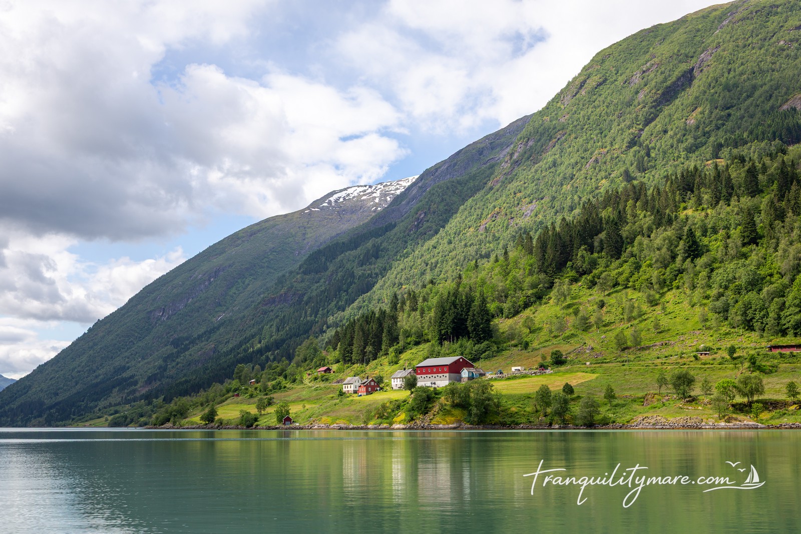
It’s also worth remembering that although the fjord is incredibly deep in the middle, most marinas, guest pontoons, and villages are built on small river deltas or narrow flat areas at the foot of the mountains. That’s where you’ll find most of the life along the fjord. And almost every one of these tiny settlements offers views that would be the highlight of a trip anywhere else.
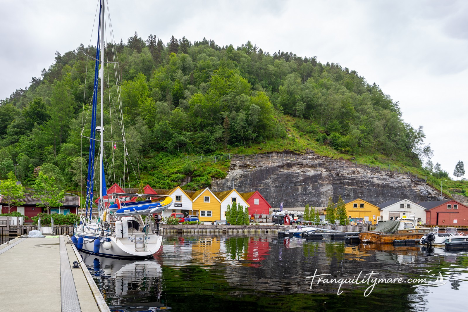
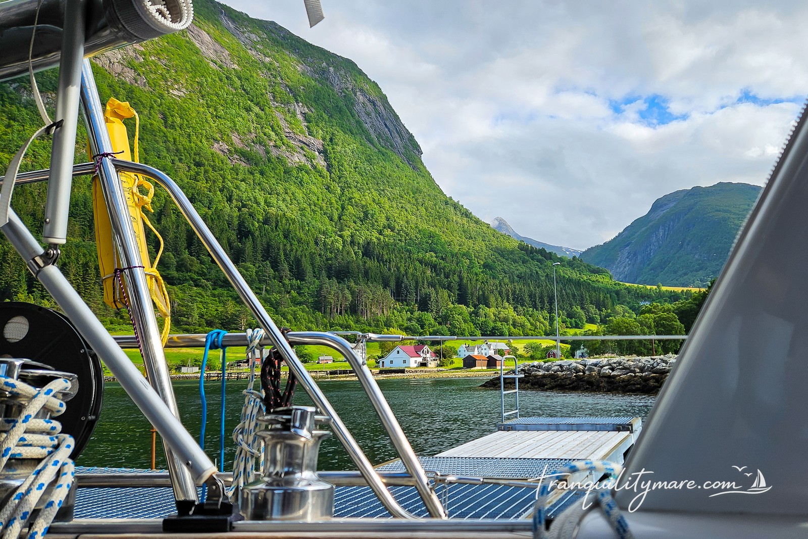
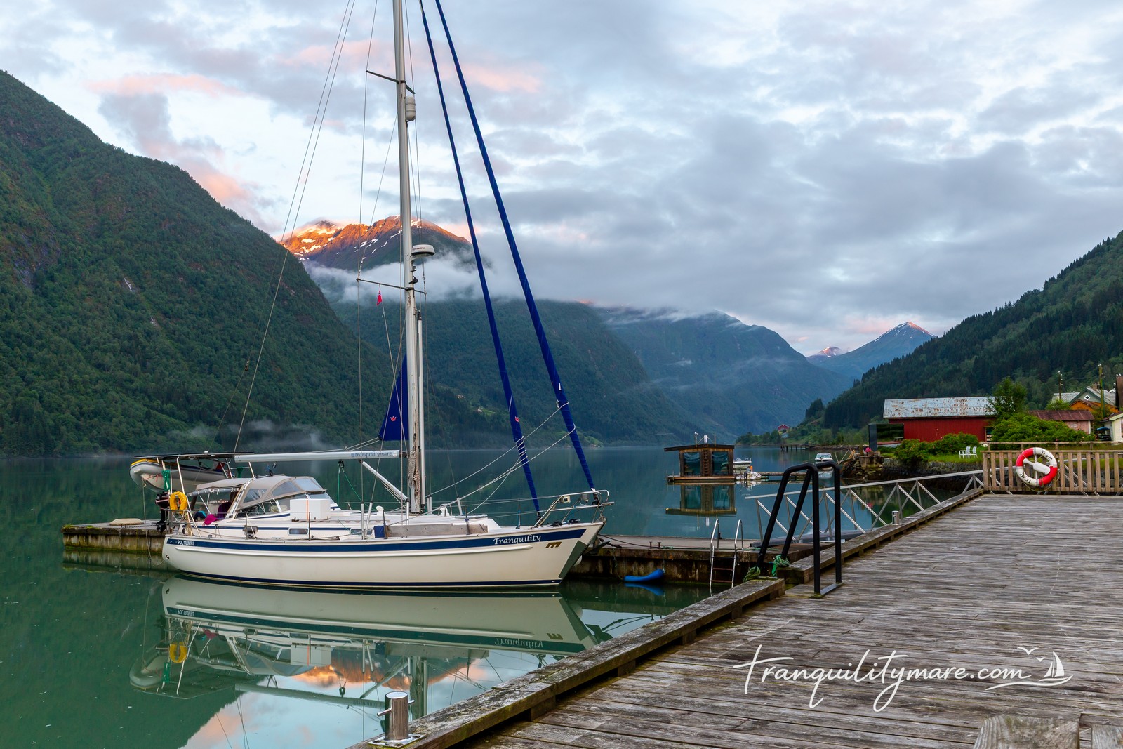
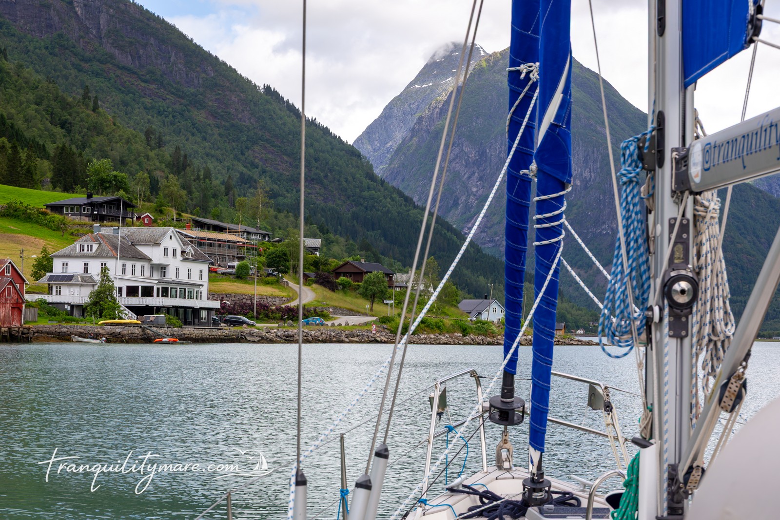
Leirvik i Sogn
Our first stop was the small village of Leirvik i Sogn, located in one of Sognefjorden’s branches called Bøfjorden. It’s a natural harbour, well protected from every wind direction, making it an excellent place to wait out bad weather. That wasn’t necessary for us, though. The forecast for the next two weeks looked almost perfect.
Berthing in Leirvik i Sogn
We spent the night alongside the guest pontoon belonging to Leirvik Kro og Motell. The hotel can also arrange access to electricity, water, and fuel.
Although it was our first stop in Norway, we were already impressed. This was exactly how we had imagined Norwegian harbours: a handful of colourful houses scattered across the hillside, crystal-clear water, complete silence, and mountains towering above everything. We couldn’t have asked for a better welcome.
Hiking from Leirvik i Sogn
The only thing missing in Leirvik was easy access to hiking trails. The best hikes in the area lead into the Lihesten massif, but the trailheads are several kilometres from the harbour. Reaching them means walking along local roads, something we really don’t enjoy.
The forecast promised sailing conditions for the following day. So instead of putting on our hiking boots, we decided to sail further into the fjord.
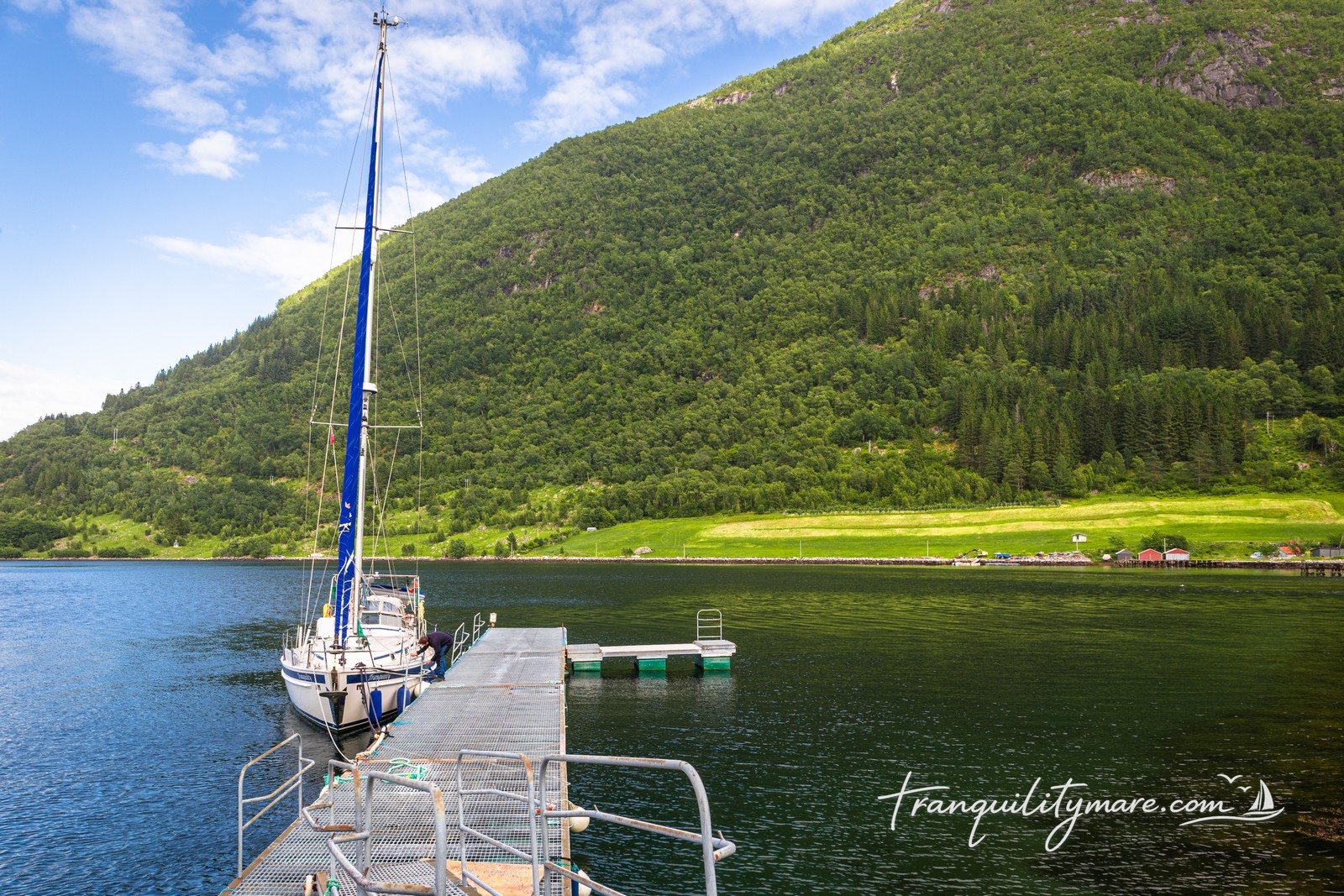
Ortnevik
Time to move to the southern side of Sognefjorden. Our next stop is Ortnevik, an even smaller and even more beautiful village surrounded by steep mountains.
Berthing in Ortnevik
The guest pontoon doesn’t look particularly sturdy, but the forecast is calm, with no strong winds expected. There is room for no more than two yachts.
As we come alongside, we quickly realise that the biggest challenge isn’t the pontoon itself. It’s the strong current from the river flowing into the fjord, pushing us away from the dock. Over the next few days, we also notice that the strength of the current changes significantly throughout the day.
We check our mooring lines several times and protect them against chafe. The next morning, we’re heading into the mountains for a two-day hike, leaving Tranquility on her own.
We spend the rest of the afternoon and the entire evening sitting in the cockpit. The scenery is so spectacular that every few minutes we catch ourselves looking in a different direction. We simply can’t decide which view is better.
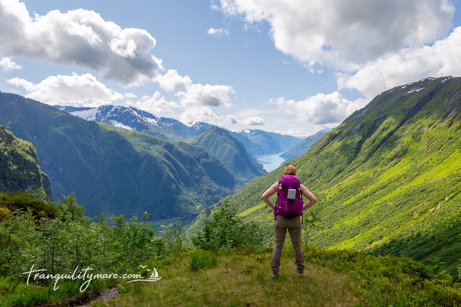
Hiking from Ortnevik to Solrenningen
The next morning, we set off on the trail to Solrenningen. The plan is simple: hike to the cabin, spend the night there, and return to the boat the following day.
It’s the 30th of June, while the official hiking season in Norway doesn’t begin until July. Before reaching the main trail, we follow a much less-used route. From the very beginning, it’s clear that the path is barely visible and poorly marked. The faint tracks we try to follow often don’t match what our maps show. Pushing through vegetation and constantly searching for the correct route slows us down far more than we expected.
As we gain elevation, we leave the forest behind and reach the first patches of snow. At first, they make us smile like children. We have no idea how much trouble they’ll cause later that day.
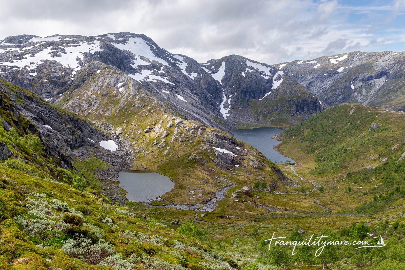
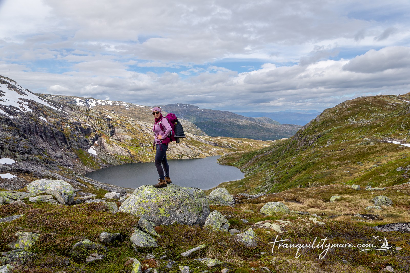
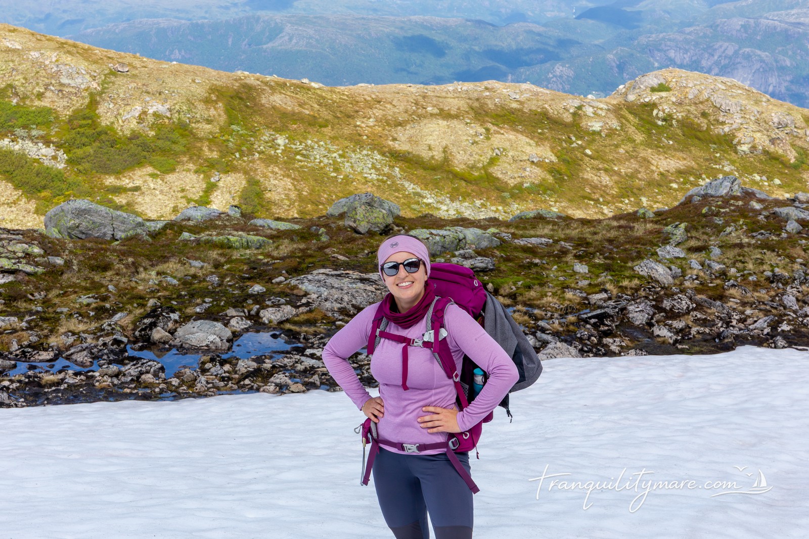
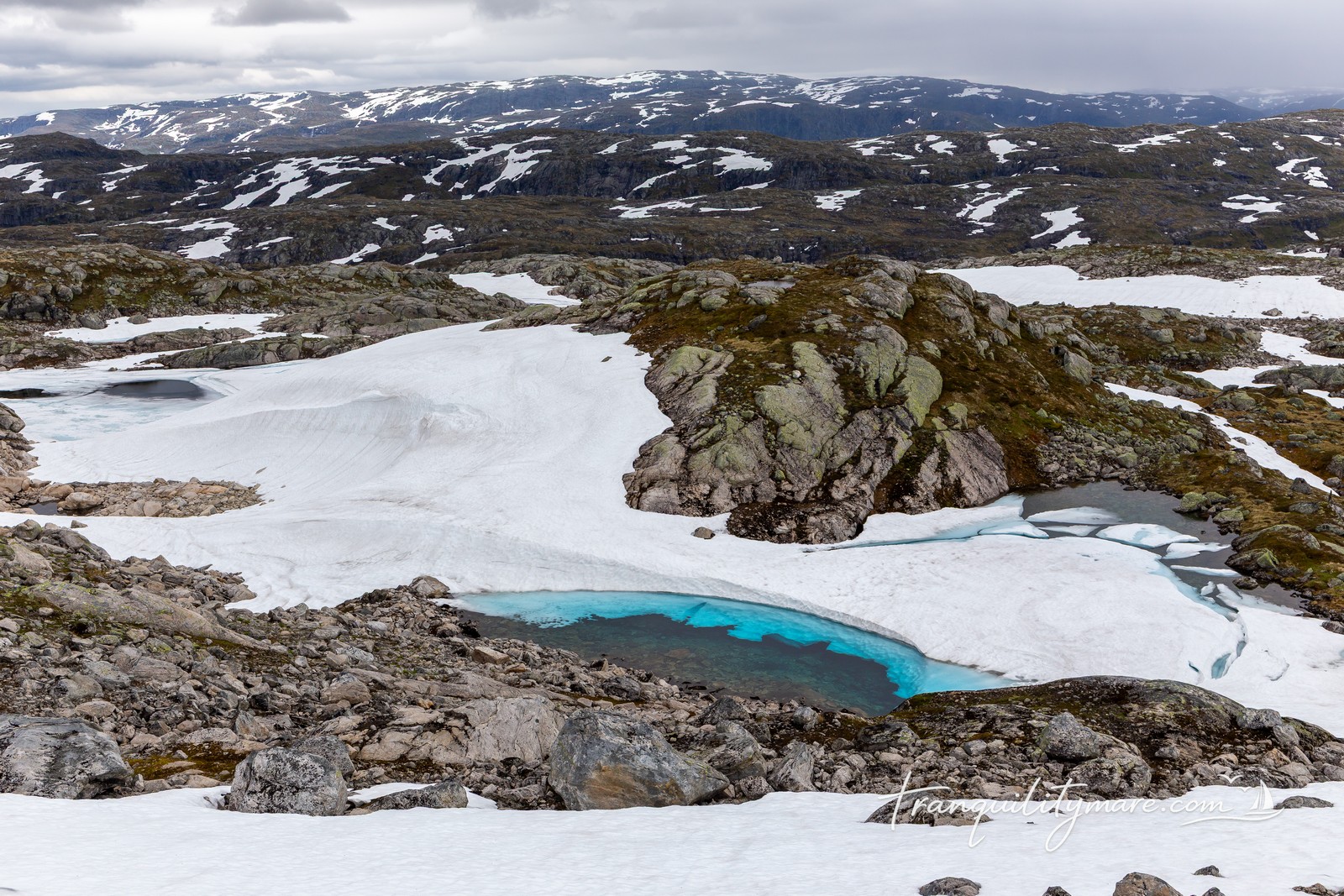
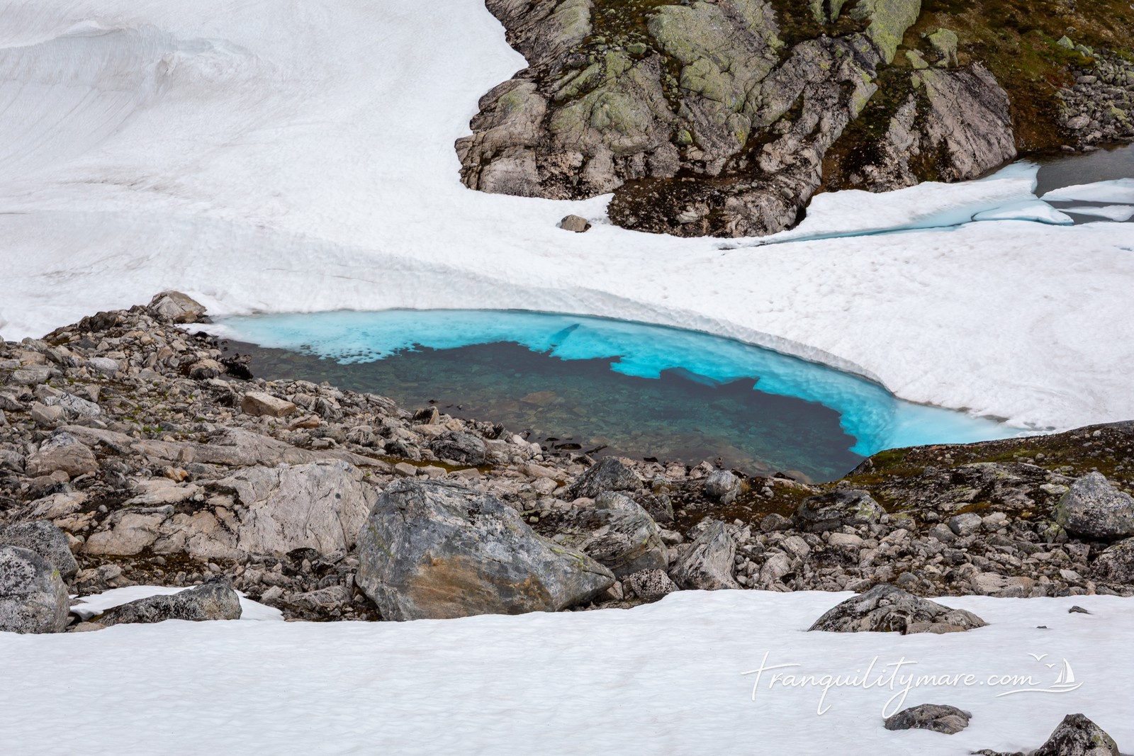
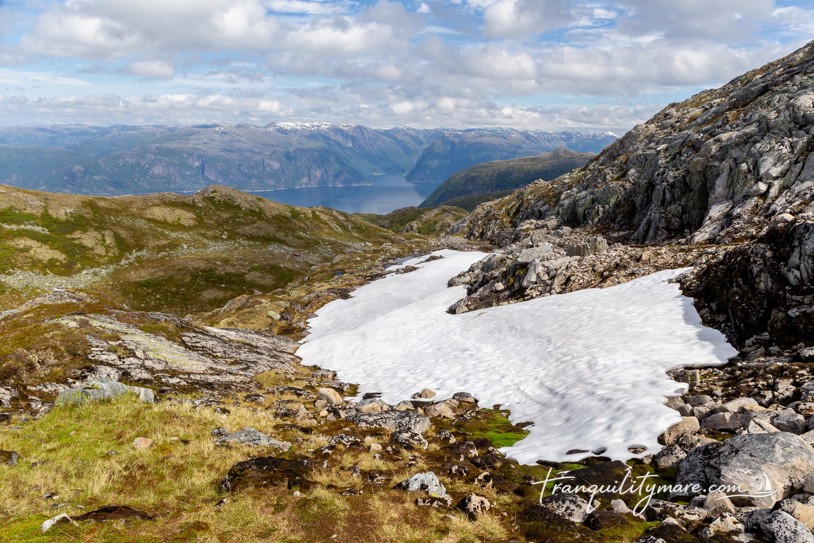
Above the tree line, the landscape becomes rocky and much more rugged. Navigation is easier, but the terrain remains demanding. We cross countless streams and small rivers, often using snow bridges formed over the flowing water. Every crossing needs to be checked carefully, and sometimes we have to make long detours to find a safer place to cross.
The scenery is incredible. In the few moments when we’re not completely focused on where to place our next step, we stop to admire the landscape around us. Small, bright blue lakes formed by melting snow look both magical and slightly unsettling.
Soon, time starts working against us. The hike is taking much longer than planned. Fortunately, we eventually reach the junction with the main trail. From there, the markings improve, and navigation becomes much easier.
We cross to the other side of the mountains, and from the final ridge we finally spot our cabin.
Only the descent remains. Unfortunately, the trail leads through wet, boggy ground. With every step, more water finds its way into our boots. By the time we arrive, we’re completely soaked.
Then it starts raining.
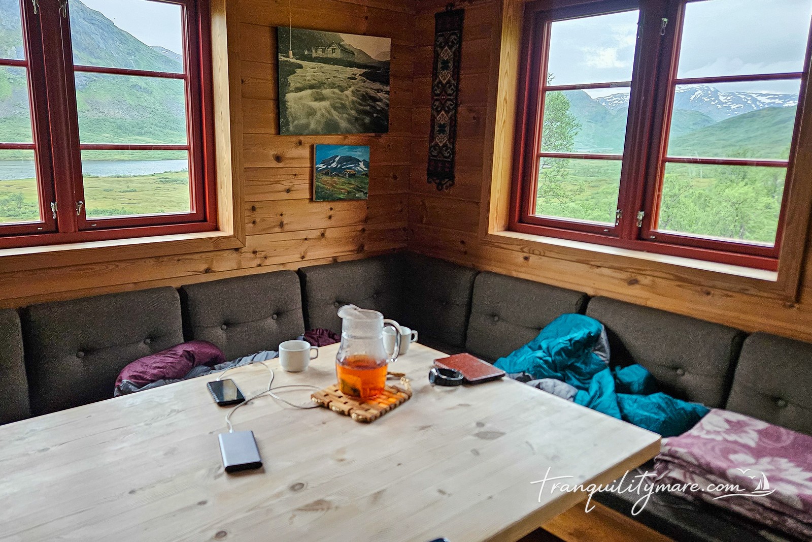
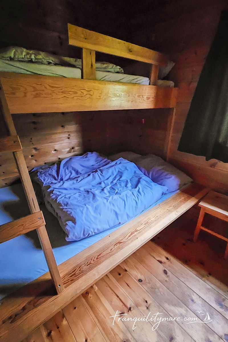
DNT Solrenningen Cabin
The Norwegian mountains are covered by a dense network of cabins run by DNT (Den Norske Turistforening) – the Norwegian Trekking Association. Some are open to everyone, while others are accessible only to DNT members with the appropriate key. They also vary in standard, from simple self-service huts to well-equipped mountain cabins.

Solrenningen definitely belongs to the latter group. It has a fully equipped kitchen and even a small shop stocked with basic food supplies. You simply take what you need and pay through the DNT app, which is also used to pay for your overnight stay. The beds have duvets and pillows, but you’re required to bring your own sleeping bag or sleeping bag liner.
The facilities are simple, yet surprisingly comfortable for such a remote location. The toilet is in a separate building outside, fresh water comes from a nearby spring, and there is no electricity. There is, however, plenty of firewood. So our first job after arriving is to light the wood stove, dry our soaking wet gear, and finally warm up after a long day on the trail.
Even though it had been a demanding hike, we were absolutely thrilled to be there. We had reached a cabin surrounded by the Norwegian wilderness, far away from roads, crowds, and everyday life. For a few hours, we had the whole place entirely to ourselves.
Later that evening, two volunteers arrived to prepare the cabin for the upcoming hiking season. They told us a lot about how the DNT network works and how much effort goes into maintaining cabins in such remote parts of Norway.
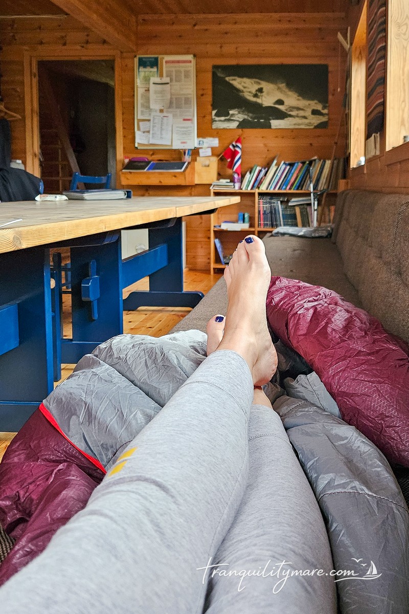
We spend the evening drinking hot tea and eating a freeze-dried meal, wrapped in our sleeping bags. Sitting in the warm cabin, we both agree that we wouldn’t trade this simple mountain hut for any five-star hotel.
Outside, just as the forecast predicted, a light rain falls through the evening. Tomorrow morning is supposed to be clear.
Back to Ortnevik
When we wake up, it’s immediately clear that the rain hasn’t stopped. If anything, it’s raining even harder. We wait. Minutes turn into hours, but outside everything is still grey and wet. We consider taking a different route back to the boat, but none of the alternatives seem like a good idea. The only sensible option is to return the way we came, and we need to do it before dark.
Eventually, we can’t wait any longer. It’s still raining, but we set off anyway. Our gear had managed to dry overnight, but after just a few steps along the waterlogged trail, everything is soaked again. Our boots are quickly full of water. The weather is much worse than the forecast promised, although the rain slowly begins to ease. Navigation is a little easier this time because we already know the route. Before long, though, a new problem appears.
The thick snow bridges that had safely carried us across streams and rivers the day before have partly melted after a night of rain. Heavy rainfall and rapid snowmelt have also raised the water level, turning the rivers into fast-flowing torrents.
Once again, we start searching for safer places to cross. Time is slipping away. Several times, with no better option, we spend long minutes carrying rocks into the river to build crossings. It’s a true Sisyphean task. Many of the boulders we struggle to move are swept away by the current almost immediately. Once again, it’s us against nature.
It isn’t until the afternoon that the clouds finally begin to clear. By then, we’re already back in easier terrain, gradually descending below the rocky slopes and into the forest. One more very steep descent, and we’re back in the village.
Ironically, the final three kilometres along the paved road are some of the hardest of the entire trip. Our feet have already spent two full days inside soaking wet boots, and every step is becoming more painful.
The Hardest Hike
This was one of the hardest hikes we’ve ever done, perhaps the hardest. It challenged us physically, technically, and mentally. We spend a lot of time in the mountains, including winter conditions, and we’re comfortable hiking on snow. Even so, Norway reminded us that its mountains deserve enormous respect, no matter how experienced you are.
June in the Norwegian mountains is still winter, especially at higher elevations. We completed the route safely, and we believe that was thanks to our preparation and previous experience. Even so, we wouldn’t recommend this hike to beginners or to anyone without experience travelling on snow and in demanding mountain terrain. It’s a genuinely challenging route.
Our reward is waiting back in Ortnevik. Tranquility has spent two days alone at the pontoon and is exactly where we left her. After everything we’ve been through, simply seeing our boat again is an enormous relief.
We’re exhausted, so we decide to stay in Ortnevik for one more day, rest, and enjoy the peace of this tiny village.
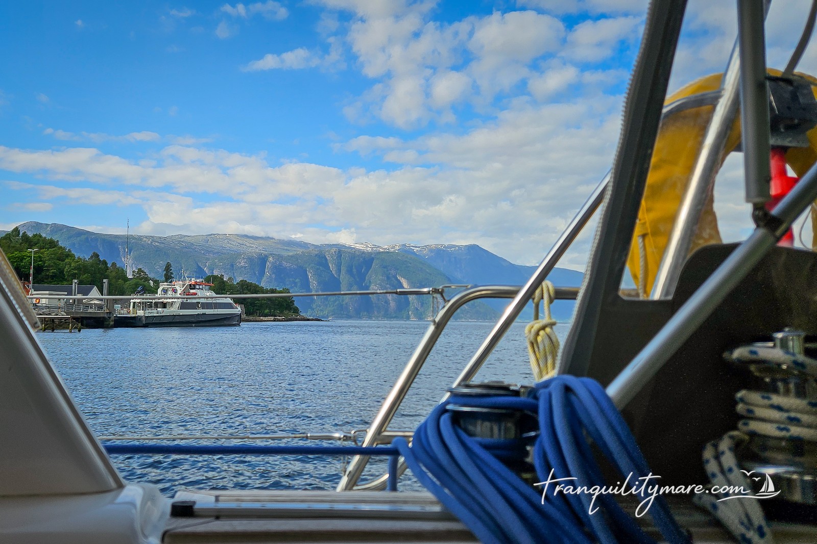
Balestrand and Esefjorden
After a short rest, it’s time to continue deeper into the fjord. We cross back to the northern shore and head for Balestrand, a small village at the entrance to Esefjorden, one of the most beautiful branches of Sognefjorden.

Berthing Options in Balestrand
According to the cruising guides, it’s possible to moor at the guest pontoon next to the ferry terminal. After taking a closer look, however, we decide against it. The pontoon doesn’t look particularly inviting, and the small marina is far too small for our yacht. It’s also worth remembering that easterly winds can make this berth unsafe.
Anchoring in Esefjorden
In our opinion, a much better option is to anchor a little further inside Esefjorden. There are good anchoring spots in around 15 metres of water, but make sure to watch out for the cables marked on the charts.
I probably don’t need to say it again, but this place is even more spectacular than the last one. The anchorage in Esefjorden easily makes it into our personal TOP 3 Anchorages we’ve ever visited aboard Tranquility. It’s also one of the very few places where anchoring is actually possible in Sognefjorden. Throughout most of the fjord, the mountains drop almost vertically into the water, where depths quickly reach hundreds of metres, leaving very few suitable anchoring spots.

What to see in Balestrand?
Balestrand itself is also well worth a few hours ashore. Since the late 19th century, it has been a popular destination for European aristocrats and artists. Right on the waterfront stands the historic Kviknes Hotel, one of Norway’s most famous historic hotels. For well over a century, it has welcomed royalty, artists, and politicians. Its most famous guest was Kaiser Wilhelm II of Germany, who was staying here in the summer of 1914 when he received the news that the First World War had begun. The chair he was sitting in at that moment can still be seen inside the hotel.

As you walk through the village, it’s impossible to miss St. Olaf’s Church. This Anglican church was built in the late 19th century for British visitors travelling through Sognefjorden. Even today, it belongs to the Diocese in Europe of the Church of England, whose bishop’s seat is… in Gibraltar!
Balestrand is also a great place to restock. You’ll find well-stocked supermarkets and a few restaurants in the village.
Hike to Keipen
This was also where we had planned to start the hike to Keipen (938 m), one of the best viewpoints over Sognefjorden. After our previous mountain adventure, however, we approached the idea much more cautiously. The summit is higher, the trail is steeper, and there was still a huge amount of snow at higher elevations.
After checking the conditions, we concluded that it was simply too early in the season. A safe ascent would have required full winter mountaineering equipment, including crampons and an ice axe. This time, we decided to leave it for another visit.
Sailing Fjaerlandsfjorden
The most anticipated part of our Norwegian adventure is finally here. We set course for one of the most beautiful branches of Sognefjorden – Fjaerlandsfjorden. This long, ever-narrowing fjord leads to the small village of Fjaerland, also known as Mundal. It will become the northernmost point of our 2025 voyage.
As soon as we enter the fjord, we spot the first glacier tongues reaching down between the mountains. With every mile we sail, the scenery becomes even more magical. The steep mountain walls draw closer together, and the glacier, which at first is only a distant shape on the horizon, stays with us throughout our time in this extraordinary place.
When sailing into Fjaerlandsfjorden, it’s worth remembering that strong north-westerly winds can create powerful katabatic winds descending from the surrounding mountains.
Fjaerland – Norway’s Book Town
For the night, we tie up at the floating guest pontoon in Mundal, which has room for no more than four yachts. It’s also possible to berth alongside the quay, but as we weren’t sure about the depth there, we chose the pontoon instead.
It’s spectacular.
Again.
Fjaerland is known as Norway’s Book Town. Along its main street, you’ll find several well-stocked second-hand bookshops filled with thousands of used books covering almost every subject imaginable and in many different languages. Of course, we have to check the Polish section as well. Unfortunately, it’s mostly filled with questionable romance novels that used to be given away with women’s magazines years ago.
But we didn’t sail here for the books.

Jostedalsbreen Glacier Hike
The main reason for stopping in Mundal is the hike to Jostedalsbreen Glacier, clearly visible from the village. Before we even reach the trailhead, however, we have to walk more than seven kilometres along the road. We hope it will be worth it.
The climb begins on a steep forest trail. Over just five kilometres, we gain around 1,000 metres of elevation. It’s hardly surprising. Norwegian mountains rise almost straight out of the fjord.

Along the way, we cross mountain streams and gradually climb above the tree line. The scenery changes from lush green forests to a rugged, rocky landscape. In a few places, the trail markings are not very obvious, and we have to spend some time finding the right way.
Eventually, the route splits into a loop. We choose the clockwise option, and it turns out to be a great decision. The hike passes quickly thanks to the company of a friendly group of hikers from a Greek mountaineering club.
The official trail ends at a small cabin just below the glacier’s moraine. It’s well worth walking a little farther, though. We descend to a small glacial lake, climb onto the moraine, and follow its ridge for an incredible view of the glacier’s snout.
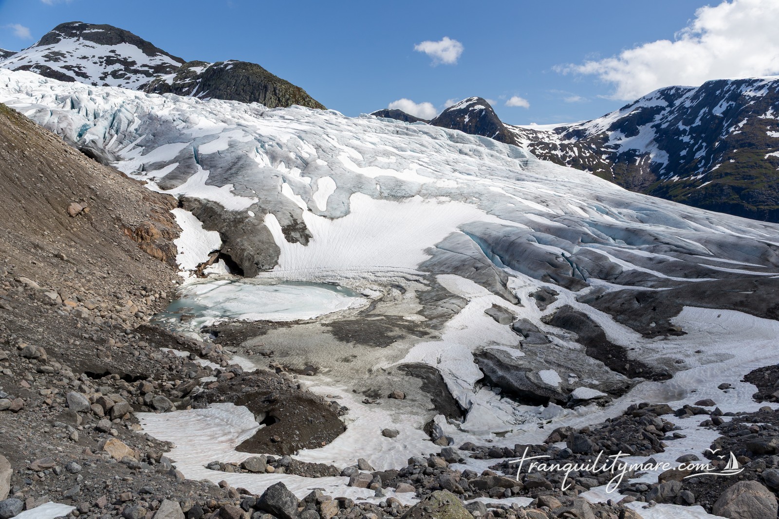
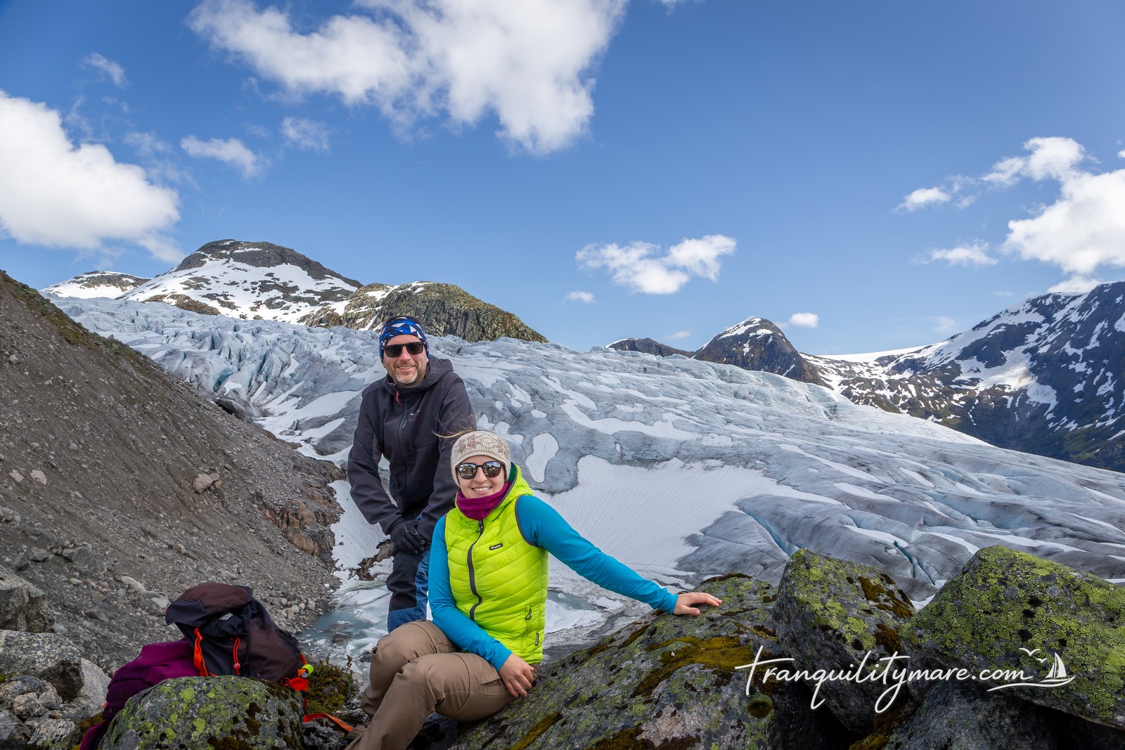
Jostedalsbreen is truly impressive. It’s not just the view. Every now and then, the silence is broken by the loud crack of ice calving from the glacier.
The contrast makes the scenery even more remarkable. Behind us is a harsh, almost Arctic landscape. In front of us, lush green forests stretch all the way down to the blue waters of the fjord. It’s hard to imagine two more different worlds meeting in one place.

As usual, we stop every few minutes for photos, to admire the view, and simply to take it all in.
We return via the other half of the loop, which means that almost every corner reveals a new view. Once we reach the junction again, we follow the familiar trail back to the road. Unfortunately, we still have more than seven kilometres of walking on asphalt before we reach the village.
We try hitchhiking, but Norwegians don’t seem to be as eager to pick up hikers as the people of Shetland, who often stopped even when we weren’t trying to get a lift.
Tired and happy, we finally make it back to Tranquility. By the end of the day, we’ve covered around 25 kilometres – 10 kilometres on the mountain trail and another 15 kilometres along the road.
But you know what?
It was absolutely worth it.
We didn’t get the chance ourselves, but we’ve heard that it’s possible to rent bicycles in Fjaerland. That would definitely be the best alternative to the long walk to and from the trailhead.
Floating Sauna
And what’s the best way to recover after a day like this?
A floating sauna, of course.
It’s moored just a few dozen metres from our boat. You simply book a time slot, and all the instructions are posted at the entrance. We sit inside, warming up while looking out at Tranquility and Jostedalsbreen Glacier, the very place we had just hiked to.
It couldn’t be better.


We really don’t want to leave this place. Maybe it’s because it’s so spectacular. Maybe it’s because there’s a floating sauna right next to our boat. Or maybe it’s simply because, from this point on, we have to accept that we’re heading back south.
This year, we won’t be sailing any further north.
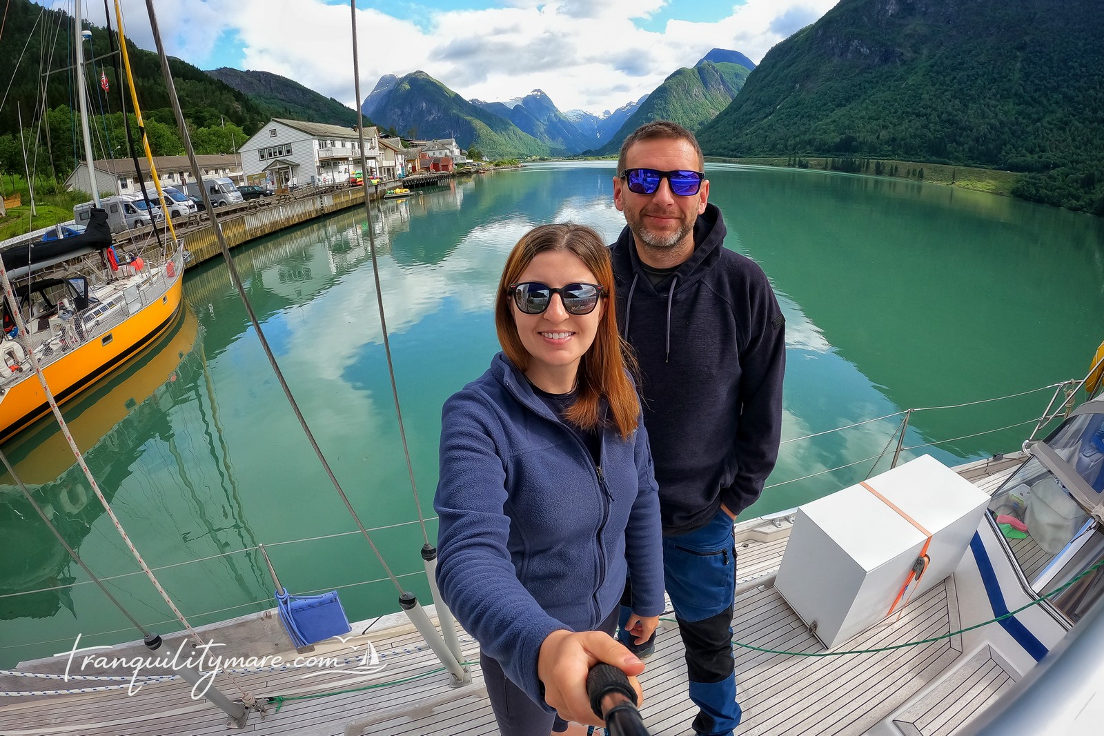
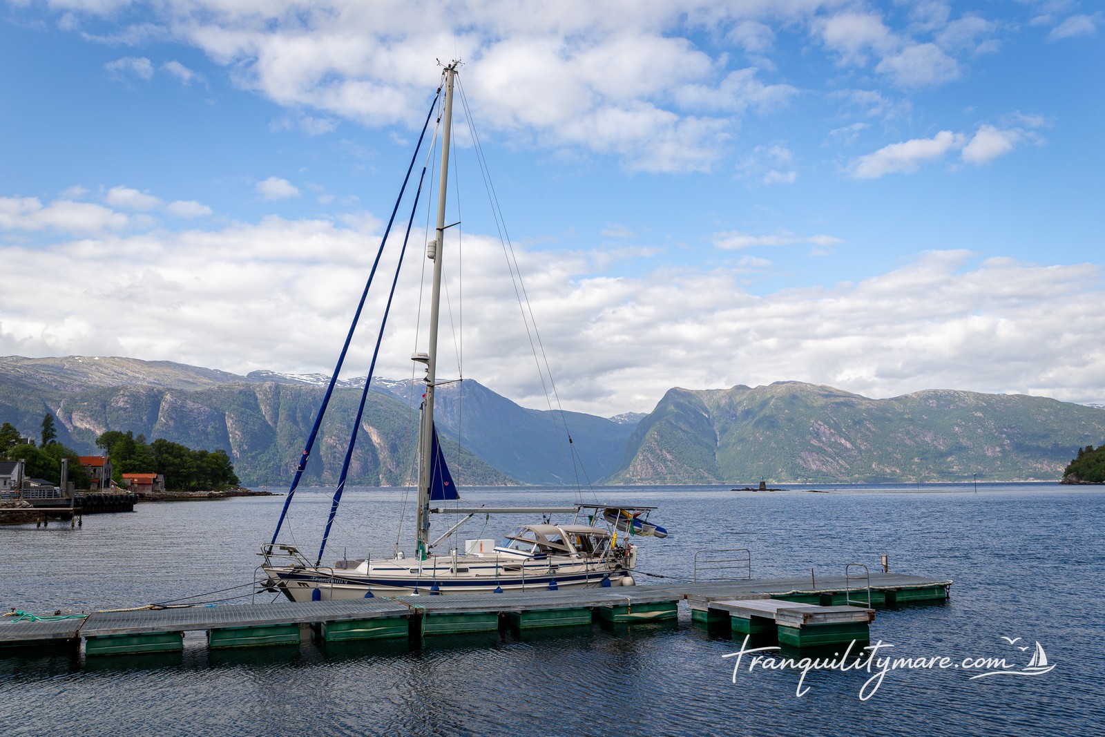
Vikøyri
Berthing in Vikøyri
Our final stop in Sognefjorden is Vikøyri, home to a surprisingly large marina for this part of Norway. We berth alongside on the inside of the breakwater, where both electricity and water are available.
The village feels almost deserted, but we don’t mind at all. Large cruise ships visit from time to time, and we imagine it gets much busier on those days. We definitely prefer Vikøyri like this. From the marina, we have a perfect view of waterfalls cascading down the steep mountains surrounding the fjord.
Vikøyri is also a convenient place to restock before the next leg of the journey, which is exactly what we do.
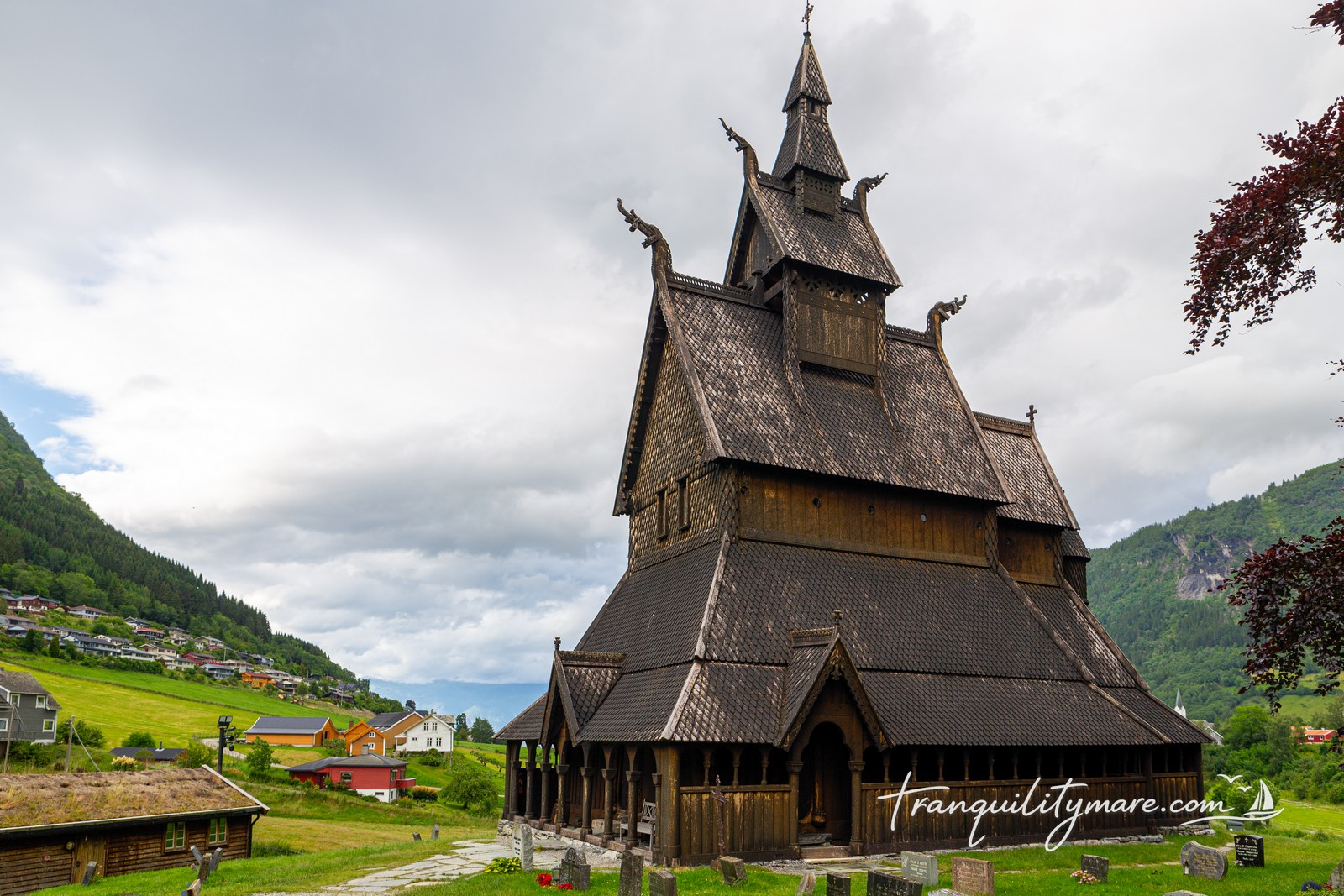
Hopperstad Stave Church
We take a short walk to Hopperstad Stave Church, one of the oldest and best-preserved stave churches in Norway. Built around 1130, it is a remarkable example of medieval Scandinavian wooden architecture. Its distinctive tiered roofs and intricately carved dragon heads make it look more like something from a Norse saga than a Christian church.

Leaving Norway
Although we could have stayed in Norway for a few more days, the forecast shows a perfect weather window for the crossing back to Shetland. It’s an opportunity we simply can’t miss.
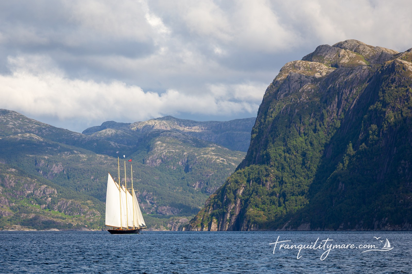
We leave directly from Vikøyri, which means the first 60 nautical miles of our passage still take us through the waters of Sognefjorden. As we pass through the skerries, we admire a beautiful tall ship gliding by, report our departure to the coastguard, and before long the Norwegian Sea opens up ahead of us once again.
Time to head back.
Places We Didn’t Visit
As is often the case in sailing, we didn’t manage to visit every place on our list. We never made it to Flåm, the most touristy town on the fjord and a regular stop for large cruise ships. And maybe that’s not such a bad thing. It might have taken away some of the feeling of wilderness that made this part of Norway so special to us.
One place we do regret missing is Nærøyfjorden. This narrow branch of Sognefjorden is considered one of the most beautiful fjords in Norway and is listed as a UNESCO World Heritage Site. There’s a small guest dock in Bakka, where you can tie up and even enjoy another floating sauna. The fjord also offers a few good anchoring spots. Bjordal also looked like a great base for several hiking trails.
But that’s sailing. We always say it’s better to leave a place wanting more than feeling you’ve seen enough. And when it comes to Norway, we don’t think the second one is even possible.
Sognefjord Sailing – Summary
Every sailor has a few places on their personal map of the world that stay with them forever. For us, this short detour from the Shetlands to Norway will definitely be one of them.
We often think back to those tiny guest docks in villages that most people have never even heard of, especially when we’re searching for a free berth in a crowded marina. We remember the empty mountain trails whenever we find ourselves sharing a path with crowds of tourists somewhere else.
And the more time passes since we left Norway, the more certain we become that one day we’ll be back.
Next time, we’ll stay longer.


No responses yet