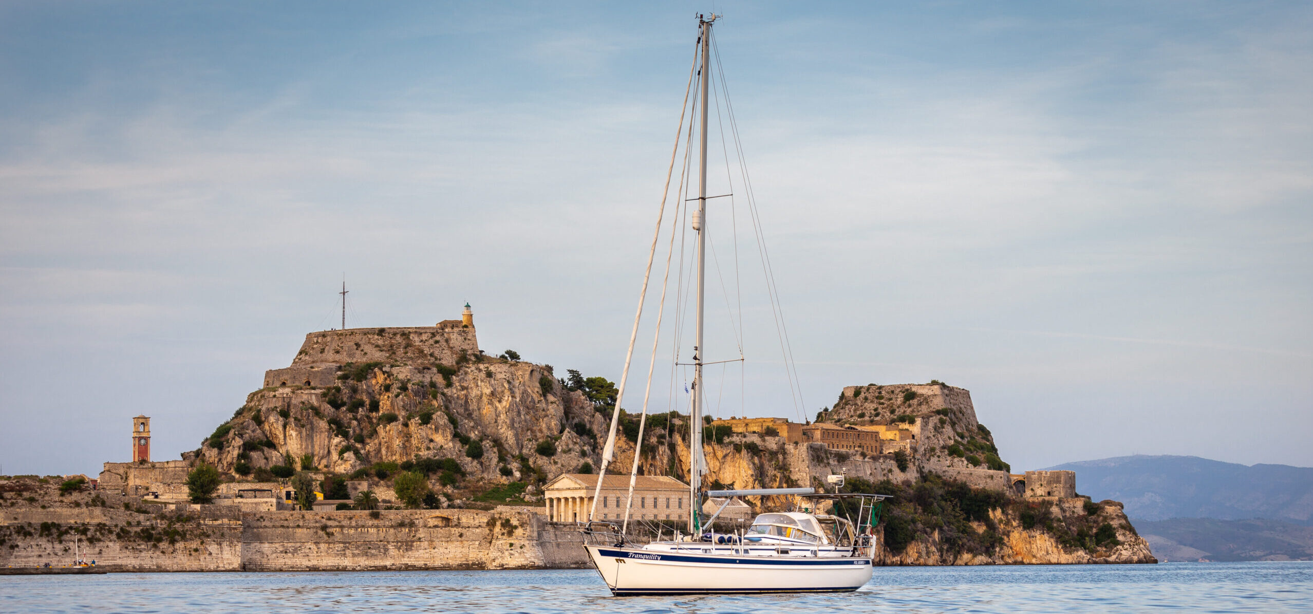
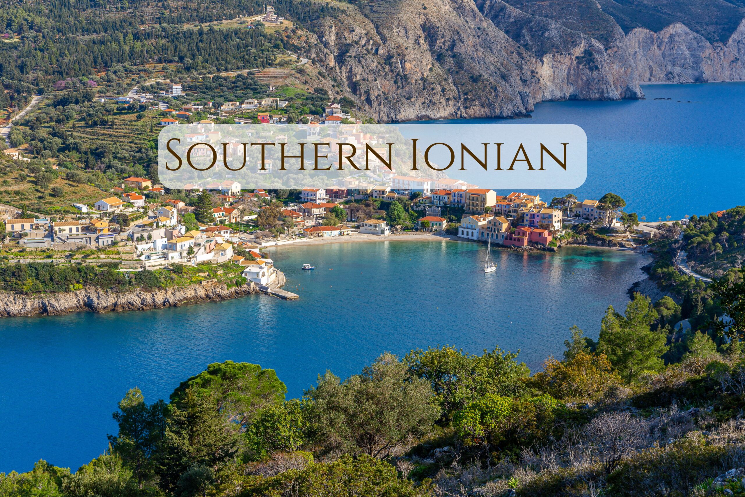
Welcome to the second part of our sailing trip around the Ionian Islands! This time we’re heading south, to islands such as Atokos, Ithaca, Kefalonia, and Zakynthos.
Off-Season Ionian Islands
Just like in the previous post, we’re describing off-season sailing, since we visited the southern Ionian Islands in early spring (March–April). Expect small bays, harbors, the first dive of the season, and even… an earthquake at sea! Or maybe we should say a “seaquake”?
As in the article about the Northern Ionian Islands (which you can read here), we only write about the places we’ve personally visited. Of course, we didn’t manage to stop in every single bay, but we hope our experiences will help you plan your own cruises and inspire you to visit some of these locations. And sometimes the opposite — because not everywhere is as picture-perfect as it might seem.
Just like in the previous post, below you’ll also find a map with the places mentioned in this article.
If you’re looking for general information about sailing in the Ionian Islands, seasonality, or weather, we also recommend checking Part 1 — Northern Ionian Islands.
Shall we?
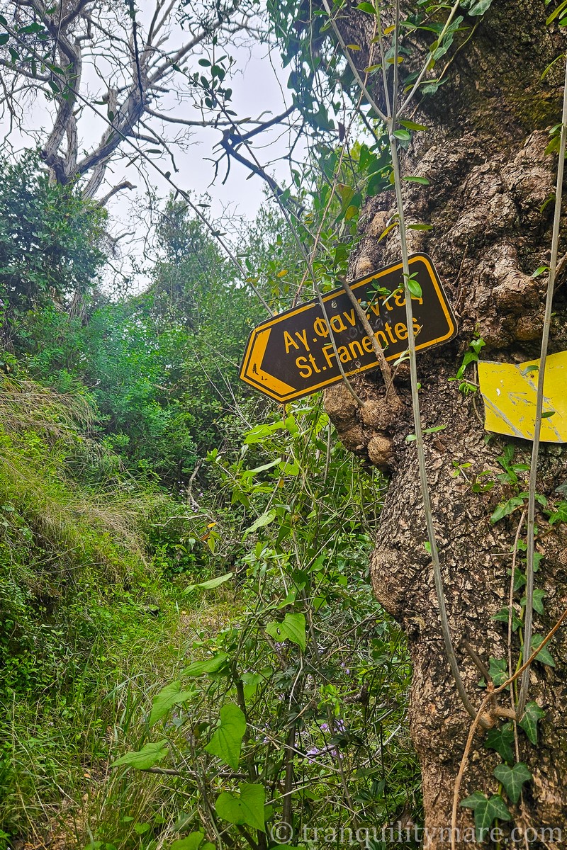
Atokos Island
Atokos – General Information
It is a small, private, and uninhabited gem of the Ionian Sea, located between Ithaca and Kastos. It is famous for its crystal-clear waters, picturesque cliffs, and peaceful coves that attract sailors in search of quiet and unspoiled nature. Although in high season, solitude can be hard to find.
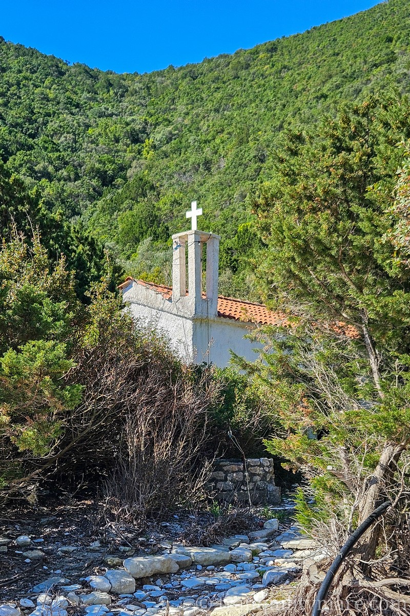
The only trace of human presence here is a tiny chapel, while goats graze on the hillsides.
Anchoring is possible in one of two bays — Cliff Bay to the south or One House Bay to the east. However, neither is particularly well sheltered from wind and swell. Gusts often sweep down from the hills and cliffs, which can ruin not only a peaceful evening at anchor, but also a night’s sleep.
Atokos – Anchoring Restrictions
|
It’s worth mentioning the official ban on anchoring, swimming, and any water activities within 300 meters of the island, effective from May 1 to October 31. This regulation was introduced to protect the Mediterranean monk seal. In practice, however, sailors report that anchoring is still possible (as of August 2025), even though the ban hasn’t been formally lifted. As is often the case in Greece, flexibility is key — while also keeping in mind the official regulations. During our visit in early April, the restrictions were not yet in force, and we had the entire island to ourselves. |
Atokos – One House Bay with Pigs
The island’s biggest attraction is One House Bay, where pigs greet visitors right on the beach. These animals love to jump into the water and eagerly wait for snacks. You don’t have to fly all the way to the Bahamas to swim with pigs! That said, keep in mind they are still wild animals. There have been cases of pig biting tourists, and overzealous pigs have even damaged dinghies or other floating gear. It’s best to approach this “attraction” with caution.
We didn’t encounter them during our visit — perhaps because, off season, the pigs knew treats were scarce. Looks like we’ll have to head to the Bahamas after all! But if swimming with pigs is high on your wish list, you’ll have a better chance of spotting them closer to the tourist season.
Ithaca
Ithaca – Where Myth Meets the Ionian Sea
From Atokos, let’s move on to Ithaca. It’s a small island in the Ionian Sea, best known as the mythical homeland of Odysseus from Homer’s Odyssey. Rugged mountains, crystal-clear waters, and charming villages create a unique blend of history, legend, and natural beauty. While there’s no shortage of yachts during the season, Ithaca is still far more peaceful than many of the busier Greek islands. Absence of mass tourism remains one of its greatest assets. Even if the bays sometimes get crowded, the reward comes in the form of mountain hikes along rarely traveled trails.
Vathy, Ithaca
The island’s largest town is Vathy, which offers a spacious, well-sheltered anchorage, plenty of berths along the quay, a fuel station, and solid town infrastructure. Though it can be noisy and busy, its charm and aesthetics make it a must-stop for many sailors cruising the Ionian Islands.
|
💡 Did you know that the name “Vathy” comes from the Greek word for “deep”? It usually refers to naturally deep, well-protected harbors. There are many places in Greece with the same name, since such safe anchorages were ideal spots for fishing villages and port settlements. |
The town quay (on the western side) and the port quay (to the south) are, as is often the case in Greece, located right next to a busy road — which is why we skip them. Instead, we drop anchor, gaining more privacy and a stunning view of the colorful town stretching across the hills above the turquoise bay. The anchorage is well sheltered from most wind directions, except from the north and northwest. During the latter, an unpleasant chop quickly built up in the bay, making the dinghy ride back to the boat with laundry a real challenge. The stay became so uncomfortable that we had to leave. A shame, really — because Vathy is definitely a place worth spending at least an afternoon!
Marmagkas Bay, Ithaca
On we sail! If you’re arriving in Ithaca from the north, Marmagkas Bay on the island’s east coast is well worth a stop. Although it’s only sheltered from westerly winds, in calm and stable weather it makes a great anchorage. In high season it can, of course, get busy, but off season we shared the bay with just two other yachts. Considering that we were completely alone in many other spots, that actually felt like a crowd. The bay itself is spacious, with a sandy bottom and excellent holding, plus pretty views. Just keep an eye out for rocks northeast of the bay’s entrance.
Palace of Odysseus, Ithaka
For fans of The Odyssey, Marmagkas Bay offers the chance for a hiking trip to ruins that some identify as the Palace of Odysseus. The trail is nearly 7 km one way, mostly along roads, and takes just under two hours. The route itself isn’t especially scenic, and the ruins are little more than fragments of stone walls without any signs, but for history buffs it may be a fascinating outing. Nearby you’ll also find the archaeological site of Agios Athanasios (the “School of Homer”). Excavations by Greek archaeologists have uncovered remains of a large 13th-century BC palace complex that may be linked to Odysseus himself.
Filiatro Bay, Ithaka
Another picturesque bay on Ithaca — so lovely that we returned twice. It’s located on the east coast, about 2 miles south of the entrance to Vathy Bay. Well protected from winds ranging from northwest through west to south, it has a sandy bottom that offers excellent holding. Beach lovers will enjoy the long, beautiful sandy beach here.
In high season, many yachts moor here with stern lines ashore, though there’s still usually space to anchor freely. Unfortunately, the bay does get very crowded at the height of summer. But if you can find a spot, it’s definitely worth stopping.
Sarakiniko Beach, Ithaka
A little further south from Filiatro lies Sarakiniko Beach, where we also stopped briefly. Off season, it’s easy to anchor right in the middle of the bay. In summer, however, much of the bay is cordoned off with swimming buoys, leaving only the option of mooring with stern lines to the north or south shore, and in fairly deep water.
Sailors note that the bay is prone to strong downdrafts and incoming swell. In short — it’s not the most comfortable place to stay during high season.
Kaminia Bay, Ithaka
A picturesque bay surrounded by high cliffs. Unfortunately, it only offers shelter from westerly winds, and there’s almost always some swell rolling in from the open sea. In high season, much of the water is cordoned off with buoys, mooring with stern lines ashore is prohibited. Also, dropping your anchor too close usually ends with a request to move further out.
Considering that there are better bays in the area (for example, Pera Pigadia just to the south), I’m not sure Kaminia is really worth a stop.
Off season, the situation is quite different. We had the bay entirely to ourselves, and only one other yacht joined us overnight. Unfortunately, the swell was noticeable the whole time — and in this respect, the season makes no difference.
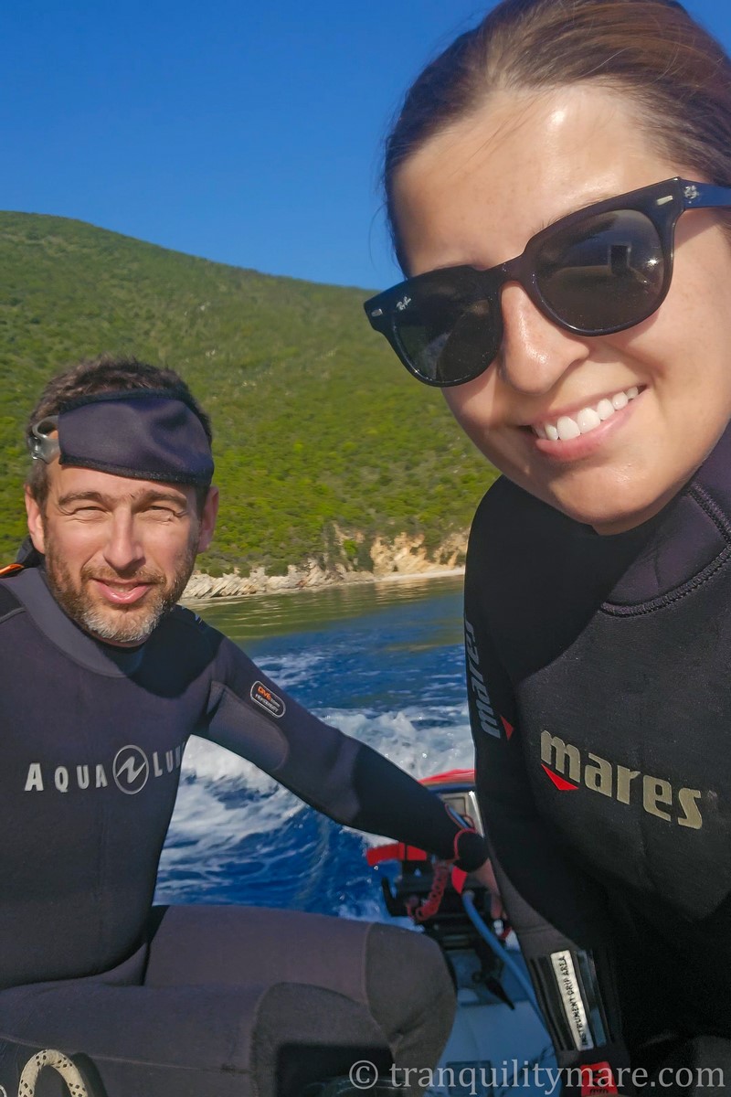
First Diving of the Season in the Ionian Islands!
Although the water temperature (17°C) wasn’t very inviting, this is where we did our very first dive of the season! About one mile southeast of the bay lies a steep drop-off that looked like the perfect spot. While it wasn’t a completely vertical cliff, this type of wall dive is one of our favorites. Crevices and caves are always full of life, and in the blue water you can often spot bigger marine animals.
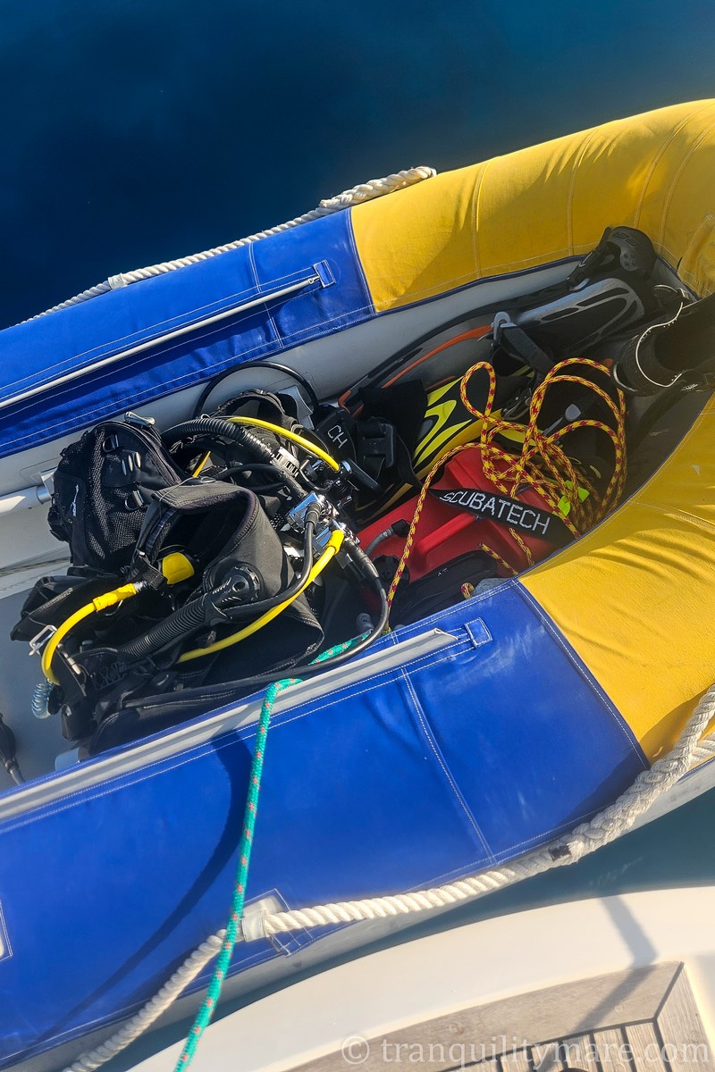
We approached this dive very methodically, since we were only just starting to dive independently from our yacht. At first, we had to work out techniques and logistics to turn our boat into a floating dive center. On top of that, this was the first dive after which we could refill our tanks ourselves using our brand-new compressor, installed on the yacht over the winter. (For the details, check out this post!) Although we don’t have photo material from this particular dive, don’t worry. We did a lot of diving in Greece, so plenty of underwater photos and videos are coming to the blog!
Ithaca — Summary
Ithaca is definitely worth visiting by yacht. You’ll find plenty of charming little bays where the lush greenery of the Ionian islands meets the turquoise of crystal-clear water. Most of them are located on the island’s eastern coast, while the western side is almost devoid of anchorages. When on Ithaca, be sure to visit Vathy — the island’s largest town.
What we did miss a bit was easy access to hiking trails directly from the shoreline. In most cases, you first have to walk quite a distance along paved roads (something we’re not big fans of) to reach the mountains.
We also didn’t manage to stop in Kioni — a charming harbor smaller than Vathy, also on the east coast. But we definitely recommend you check it out!
Kefalonia
If I had to choose just one island in the Ionian Sea that charmed me the most, it would be Kefalonia.
Kefalonia – General Information
Kefalonia is the largest of the Ionian Islands archipelago — covering over 780 km² and home to about 35,000 residents. A defining feature of its landscape are Ainos Mountains, whose highest peak rises to 1,628 meters. The mountain is covered with a unique variety of fir tree — the endemic Kefalonian black fir. Rugged mountain scenery meets a spectacular coastline here, with crystal-clear waters, sandy beaches, and dramatic cliffs. This diversity means Kefalonia truly has something for everyone — from secluded coves and beaches to mountain trails and unforgettable viewpoints.
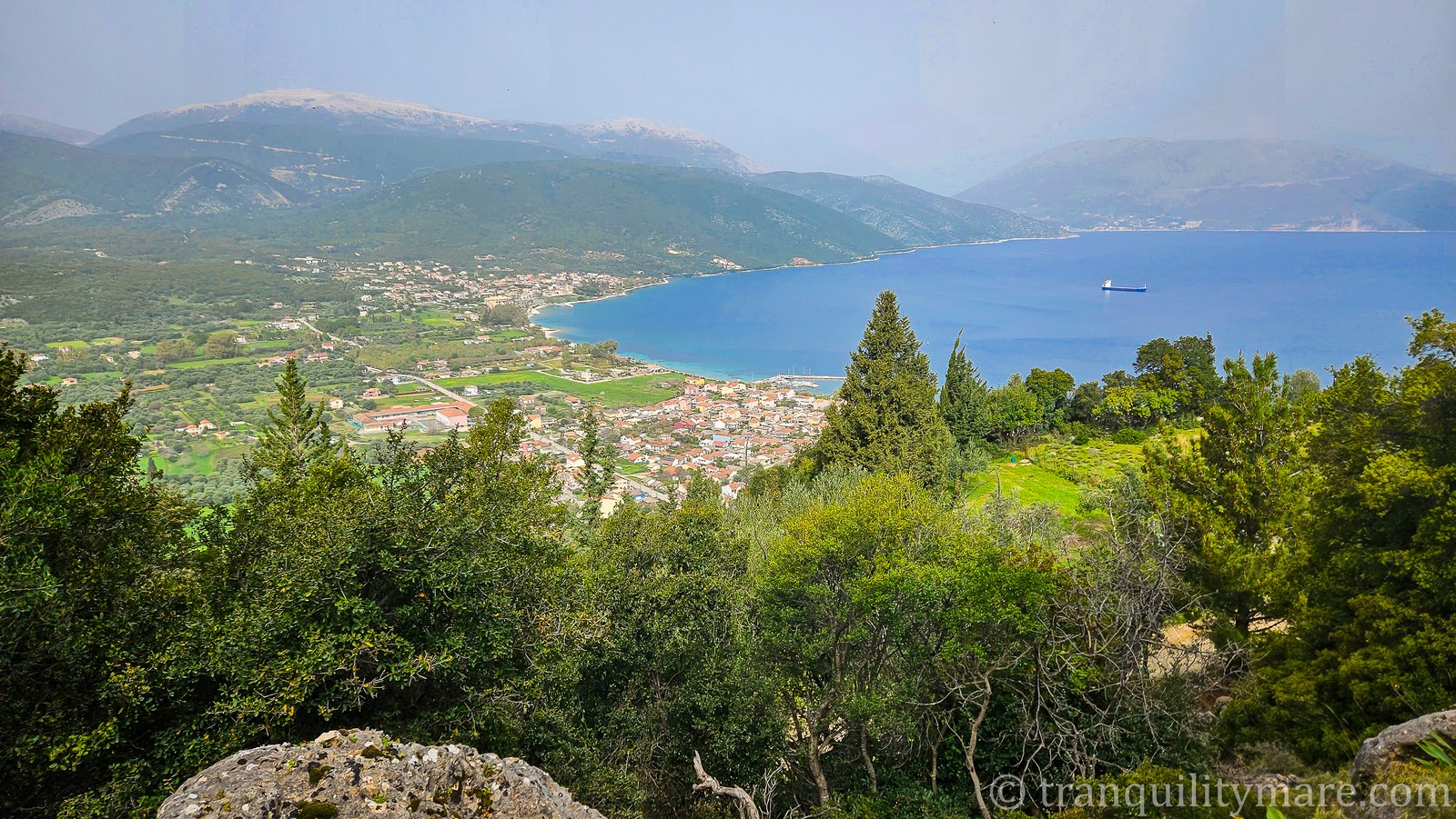
Fiskardo, Kefalonia
Fiskardo – General Information
Our Kefalonian adventure began in Fiskardo. Considered the island’s most picturesque town, Fiskardo is famous for its colorful Venetian houses, the only ones on the island that survived the devastating earthquake of 1953. It’s a popular yachting port lined with elegant tavernas, buzzing with life during the season. In April, however, Fiskardo was completely deserted, and even finding basic groceries was a challenge.
Fiskardo – Mooring Options
At first, we planned to anchor in the middle of the bay. Unfortunately, the loose gravel bottom made it difficult for the anchor to set, and the available space felt uncomfortably tight. Instead, we moored stern-to at the quay. It wasn’t completely empty — a few yachts were laid up for the winter — but there was still plenty of room.
The promenade was quiet, with only workers renovating tavernas in preparation for the coming season. Still, we fell in love with the town’s architecture and atmosphere, and the coffee we sipped in our cockpit, overlooking the peaceful, empty promenade, tasted far better than it would with crowds of tourists peering into our home.
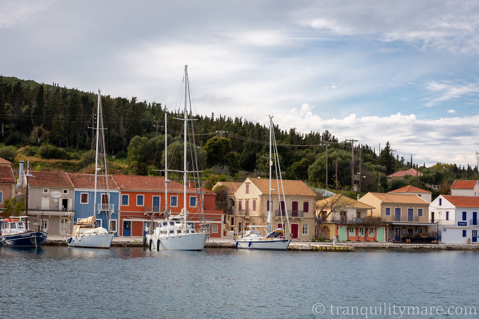
As I often repeat in these posts, things are very different in high season. Fiskardo becomes a busy, noisy port where space at the quay is hard to come by. Anchoring in the middle of the bay is problematic due to limited room and the risk of chains tangling with yachts moored at the quay. Typically, boats tie stern lines ashore around the bay. If your chain length allows, you can also anchor in deeper water just outside the bay.
For history lovers, there is a small Roman Cemetery just 5 min walk from the town.
As we sailed away from Fiskardo, I was convinced it would remain my number one spot in the Ionian Sea. But then, we reached Assos.
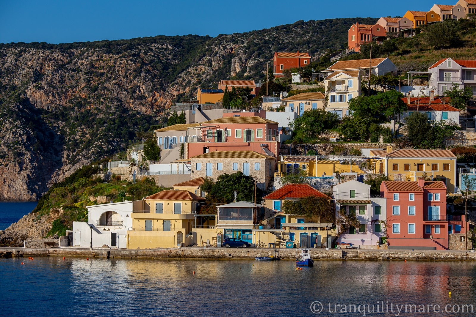
Asos, Kefalonia
Asos – General Information
I’ll never stop raving about Kefalonia. If someone asked me about the place I liked the most in the entire Ionian Sea, without hesitation I’d say Asos. It’s a charming village on the northwest of Kefalonia, beautifully located on a narrow isthmus at the foot of the ruins of a Venetian fortress. It enchants with colorful houses reflecting in the turquoise water and with its peaceful, intimate atmosphere.
Asos – Weather and Anchoring Options
Asos, unfortunately, is exposed to the frequent northerly winds in this region. It means that staying here often requires waiting for the right weather. But believe me—it’s worth it.
Outside the season we anchored in the middle of the bay, but in summer much of it is cordoned off with buoys for swimmers. Yachts moor with lines to the shore on the outside. There are also one or two spots at a very small quay, but we don’t recommend this solution. Close to shore there are rocks, the quay has very few points for tying up, and passing tourist boats generate quite a bit of wash. In the bay, much of the seabed is overgrown, which makes anchoring less reliable. Sandy patches can be found only in shallower waters, closer to the beach.
Venetian Fortress in Asos
No matter how or where you stop in Asos, you absolutely must take a short walk up to the Venetian fortress overlooking the village. It was built in 1593 as protection against pirates and the Ottoman Turks. Although initially an important defensive point for the island, over time it lost strategic significance and gradually fell into disuse. Today only fragments of walls, the gate with the emblem of St. Mark, and the ruins of old buildings remain. But you don’t go up there for the walls—you go for the absolutely stunning views of Kefalonia, the bay where your yacht is anchored, and the surrounding mountains. The trail is easy and not demanding, so anyone can reach it, and the whole route, including a walk around the top of the peninsula and exploring the ruins, is about 5–6 kilometers.
We were lucky enough to be the only yacht in Asos, right in the middle of the bay. The photo I took from the fortress is still one of my favorite shots of our yacht.

Sami, Kefalonia
Our last stop on Kefalonia was the town of Sami. It’s not as picturesque as the two previous places, but it’s a good spot to stock up on supplies or as a base for trips into the mountains.
Sami Port
We decided to stay in the town port, since the nearby Cosmos Marina didn’t appeal to us with either its prices or facilities.
The stay in the port was fine, but without electricity or water, as all the taps located under metal hatches along the breakwater were flooded with very dirty water. We moored alongside on the western breakwater. We didn’t have to pay anything, as in many other places outside the season. The breakwater provides good protection from waves in most wind directions.
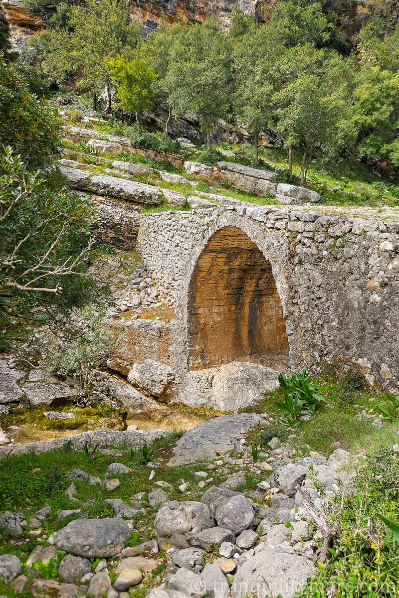
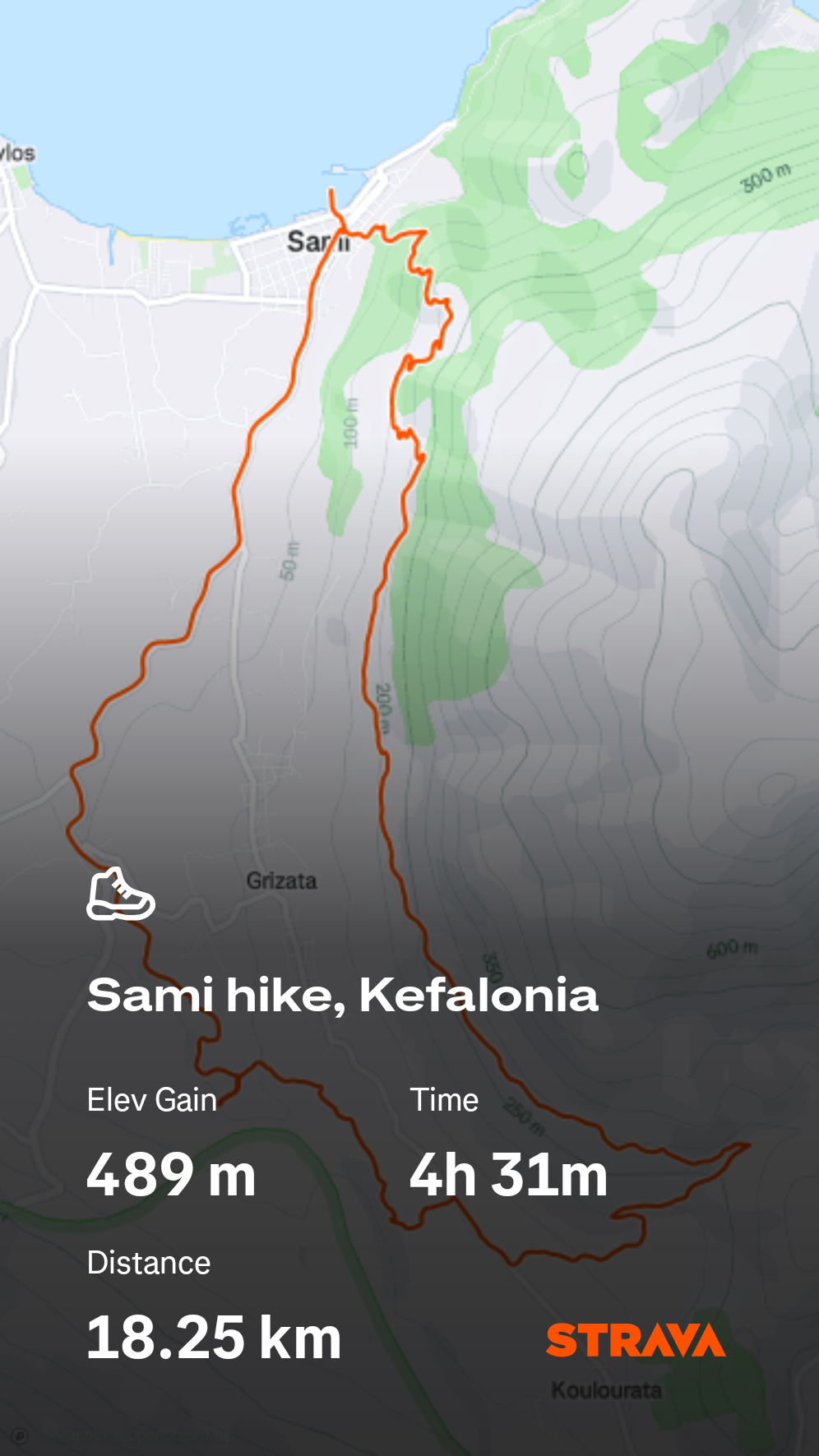
Hiking Trips from Sami, Kefalonia
From Sami, we had planned a longer trip into the mountains, aiming to climb the island’s highest peak – Megas Soros in the Ainos range, which reaches 1,628 meters above sea level. It’s also the highest point in all of the Ionian Islands, known for its endemic forests of Kefalonian black fir.
Unfortunately, this was the first and only time we felt the downside of sailing off-season. In Sami, which in summer is full of life, we couldn’t find a single open car rental, and public transport didn’t reach the place we had planned to go. But nothing was lost! Instead, we found a trail that started just outside town, and it was so scenic that we didn’t regret missing out on our original plan at all.
From Sami we first walked to the village of Mouzakata, then, passing through Koulouatra, descended to Grizata and returned back to Sami. Part of the route followed the so-called “7 Mills Trail.” The trail owes its name to the many stone ruins of watermills and farm buildings that in the 19th century used the water flowing through the valley. Today, it’s a quiet, picturesque path that lets you feel the atmosphere of old Kefalonia and discover its less touristy side. Along the way you can also see old stone bridges – remnants of past infrastructure – which now stand over dry, empty riverbeds.
The whole hike covers just over 18 kilometers (with the last stretch unfortunately along a busy road) and nearly 500 meters of elevation gain. Still, we highly recommend it if you’re in Sami!
Argostoli, Kefalonia
Perhaps an attentive reader familiar with the area has noticed that we haven’t mentioned Kefalonia’s largest town – Argostoli. That’s no accident. Of course, during the planning stage we considered stopping there – the chance to see the famous turtles living in the harbor up close was very tempting! But repeated reports from other sailors about break-in attempts and thefts effectively discouraged us. We understand that in the height of the season, at a busy quay, you have to be especially careful with belongings left on board. But reading about attempted night break-ins on yachts anchored far from town – that’s what really concerned us. Stories of hooded figures boarding boats even outside the season left us with no desire to risk it.
And it’s a pity, because Argostoli itself is surely worth visiting – if only for those turtles. It’s sad that everyone seems to know about the problem and nothing is being done. In the long run, it’s the town itself that will lose out, as tourists may start avoiding it. Or – knowing Greece – perhaps no one will even notice the absence of a few more cautious sailors.
We’re very curious about your own experiences in Argostoli – let us know in the comments!
With this slightly less pleasant note, we’ve reached the end of our journey through Kefalonia, and all that’s left is to head to our final island – Zakynthos.
Zakynthos
Zakynthos – General Information
Also known as Zante, is one of the most recognizable Ionian Islands. Its trademark is Navagio Bay (the Shipwreck Beach) – one of the most photographed beaches in all of Greece, surrounded by steep white cliffs. The island also enchants with the Blue Caves, picturesque beaches, and rich wildlife – it’s here that loggerhead sea turtles (Caretta caretta) lay their nests. The island’s capital, Zakynthos Town, combines a typically Greek atmosphere with distinct Venetian influences. Overall, the island offers excellent conditions both for sailing and for a relaxing holiday.
For us, Zakynthos was a special place – it just so happened that weather, plans, and our route aligned in such a way that we ended up spending quite a lot of time here, literally sailing all the way around the island. Strange? For us, yes, because we usually try to avoid places dominated by mass tourism. While cruising in Greece, we deliberately skipped islands like Santorini, Mykonos, Kos, or Rhodes. And yet, we lingered on Zakynthos…
Zakynthos Town
Let’s start with the island’s main town, also called Zakynthos. The town quay, often referred to as a marina (Yachting Club Zakynthos), evokes very mixed feelings among sailors. Some praise it for reasonable prices, the ability to book via Navily or phone, and the helpful staff. Others, however, tell blood-chilling stories of being charged outrageous fees for mooring or water by people whose right to collect such payments is highly questionable. Sadly, such situations are becoming increasingly common in Greek ports, for example in Nafplio. Some try to fight it, others just pay – we believe it’s generally best to avoid such places altogether.
In our case, though, things went smoothly – we were there before the season, and at the quay we didn’t meet anyone trying to charge us inflated fees. The problem only appeared later in the afternoon when more yachts began arriving. That’s when a group of men turned up on bicycles to take lines. To be fair, they did a good job helping boats struggling to moor in strong crosswinds – so, regardless of how their business usually looks, on that day at least they honestly earned their pay.
As for weather conditions, we strongly advise against mooring in this port with winds from the SW–S directions. The bay is wide enough for an unpleasant swell to build up, and yachts can end up being pushed hard against the quay.
The town itself offers everything you’d expect from a highly touristic spot – good restaurants, narrow streets, souvenir shops. Interestingly, even off-season it doesn’t feel deserted.
Laganas Bay, Zakynthos
Laganas Bay, on the southern coast of Zakynthos, is one of the island’s most beautiful spots, famous for its wide sandy beach and turquoise waters. It’s also a protected area – loggerhead turtles (Caretta caretta) lay their eggs here, which means that in many places special nature protection rules apply. The town of Laganas itself is lively and bustling in the season, offering plenty of tavernas, bars, and tourist attractions. Outside the season, however, you’ll hardly find a living soul.
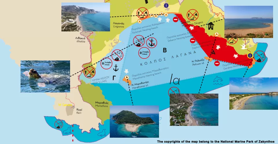
National Marine Park of Zakynthos – Ionian Islands
Below is a graphic showing the restrictions on anchoring and yacht movement within the protected area. In short:
- In Zone A there is a complete ban on anchoring and navigation,
- In Zone B you may move at a maximum speed of 6 knots, but anchoring is not allowed,
- In Zone C the same speed limit applies (6 knots), but anchoring is permitted.
These rules are in effect during the turtle nesting season, from May 1st to October 31st. Full details can be found on the National Marine Park’s website.
Laganas Bay – Anchoring Options
In early spring, there are no restrictions. We had vast stretches of turquoise water – so bright it almost hurt the eyes – entirely to ourselves. We decided to make the most of it and returned to the bay several times, anchoring in different areas. At first, we anchored northeast of the village of Agios Sostis. From there we took the dinghy to Marathonisi Island at the southern end of the bay. A well-known turtle-spotting site lies about 1.7 miles away. Unfortunately, since the nesting season had not yet started, our search was unsuccessful. A week later, we anchored north of Marathonisi to observe from closer range – again, no luck.
Gerakas Beach
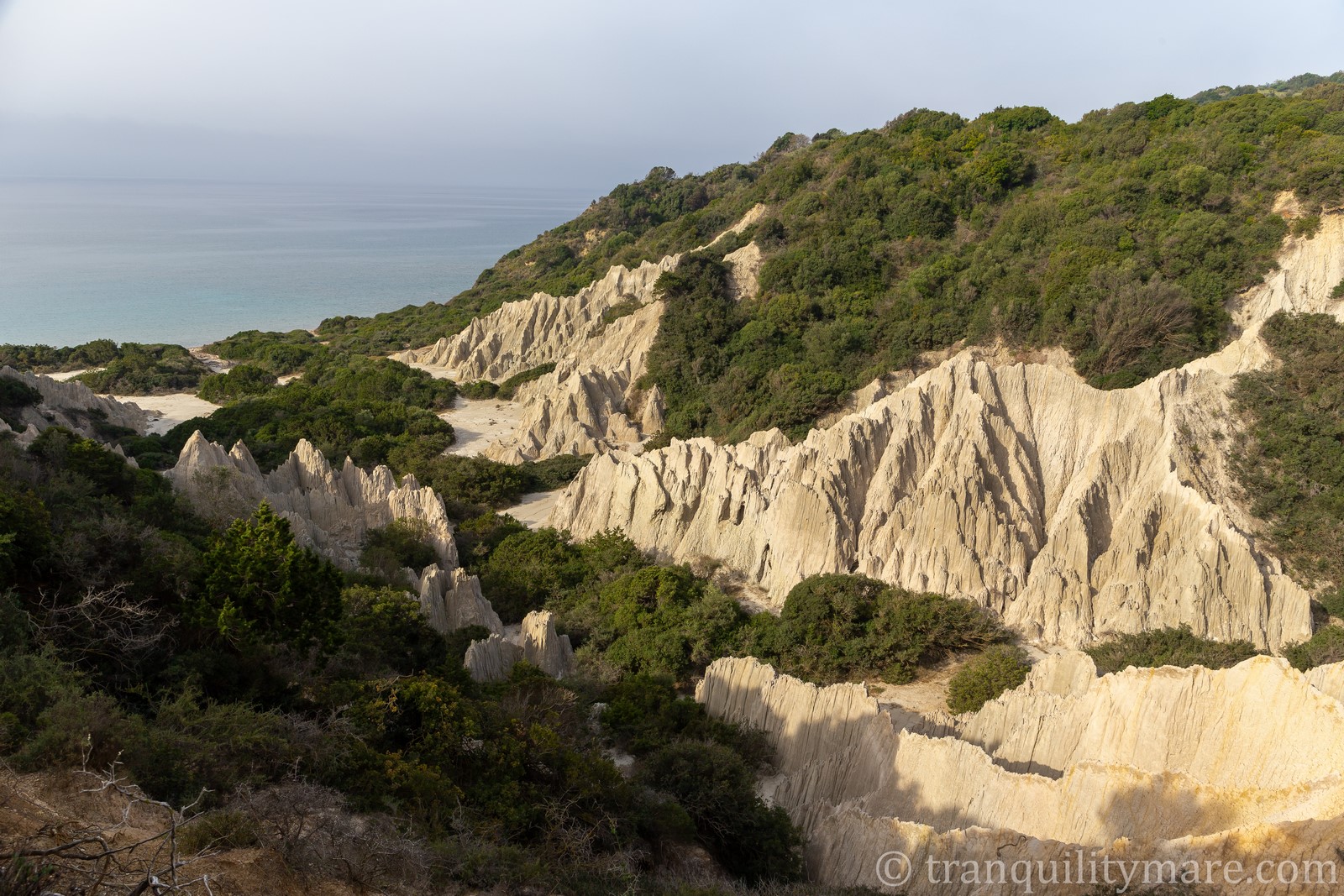
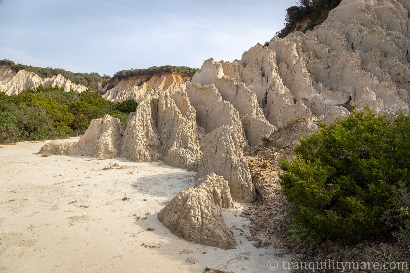
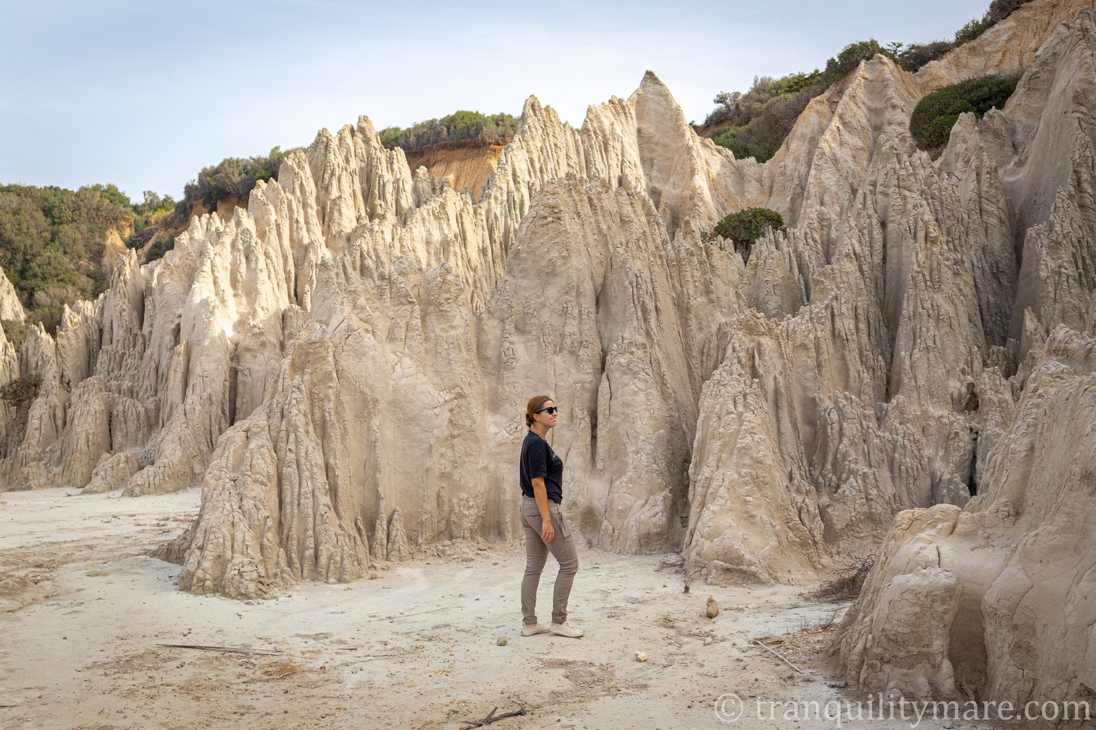
But we discovered a true paradise in the heart of Zone A, at Gerakas Beach. In turtle nesting season, this is a place where you cannot anchor or even use the beach. Outside the season, however, it quickly became our favorite corner of Zakynthos – turquoise water, rocky formations, a sandy beach, and perfect tranquility. These are the kinds of places we love most. However, pay attention to the surrounding rocks at the entrance to the bay.
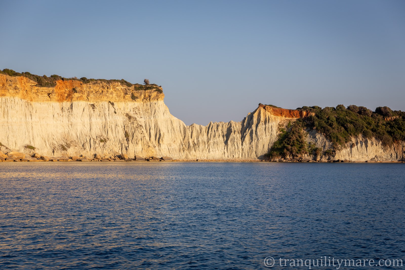
White Sandstone Mountains
If you have the chance to anchor here outside the season, it’s worth landing your dinghy on the beach and taking a short (about 10-minute) walk to the small canyon known as the White Sandstone Mountains. This is an area right next to the beach where you can admire striking sandstone formations, sculpted by erosion, contrasting beautifully with the lush greenery and azure sea. Interestingly, despite their name, these “mountains” feel soft to the touch – more like clay than sandstone. So don’t touch them too much – they’re really fragile!
On Gerakas Beach itself, you can see the installations and equipment prepared for turtle research and protection during the nesting season.
Earthquake at Sea
In Laganas Bay we also experienced another, completely unexpected adventure. During a lazy morning breakfast, our phones suddenly started making strange noises. It turned out to be an RCB alert. I had barely finished reading the message about an earthquake in the region when we felt the first tremor.
Although we had experienced earthquakes before in different parts of the world, this one was unique. The best way to describe it is this: we felt like a paper boat floating in a glass of water that someone had just shaken. The epicenter was 38 miles from our position, west of the Peloponnese, at a depth of 35 km, with a magnitude of 5.9. The following tremors were much weaker.
And honestly, if it hadn’t been for the alert, we probably would have thought it was just the mast vibrating in the wind. For yachts, the greatest danger during earthquakes comes from tsunamis. So we quickly checked whether any warning had been issued for the Ionian Islands – and found out that such warnings are only issued when the magnitude exceeds 6.5 on the Richter scale. Relieved, and with a new, unusual experience under our belt, we went back to breakfast.


Laganas Bay – Summary
Even though we didn’t manage to see the biggest attraction of Laganas Bay – the loggerhead turtles (Caretta caretta) – it was still one of our favorite places in the Ionian Islands. Looking at photos online, showing the summer crowds and the turtles being practically besieged, I can’t help but feel that the designated zones do little to truly protect them. I’m not sure I’d want to take part in that.
If you happen to visit during the season, make sure to follow the rules. In our opinion, the best anchorage is around Agios Sostis – right on the border of zones B and C.
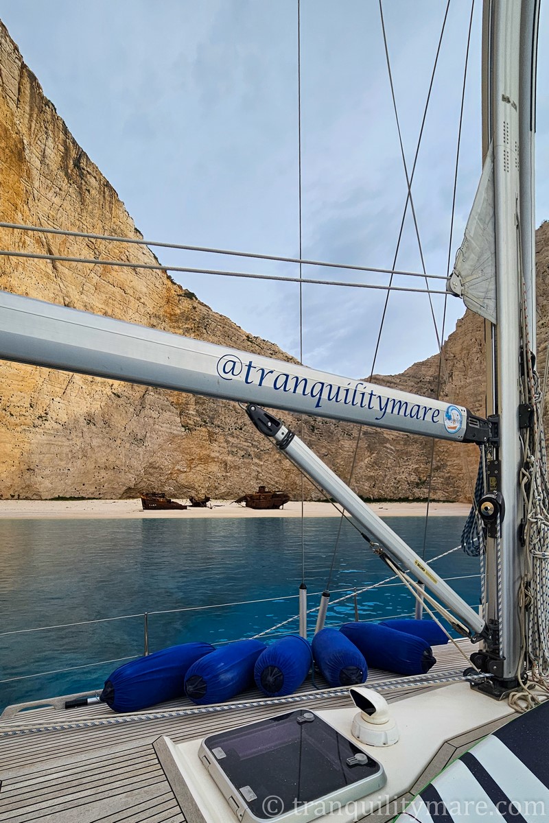
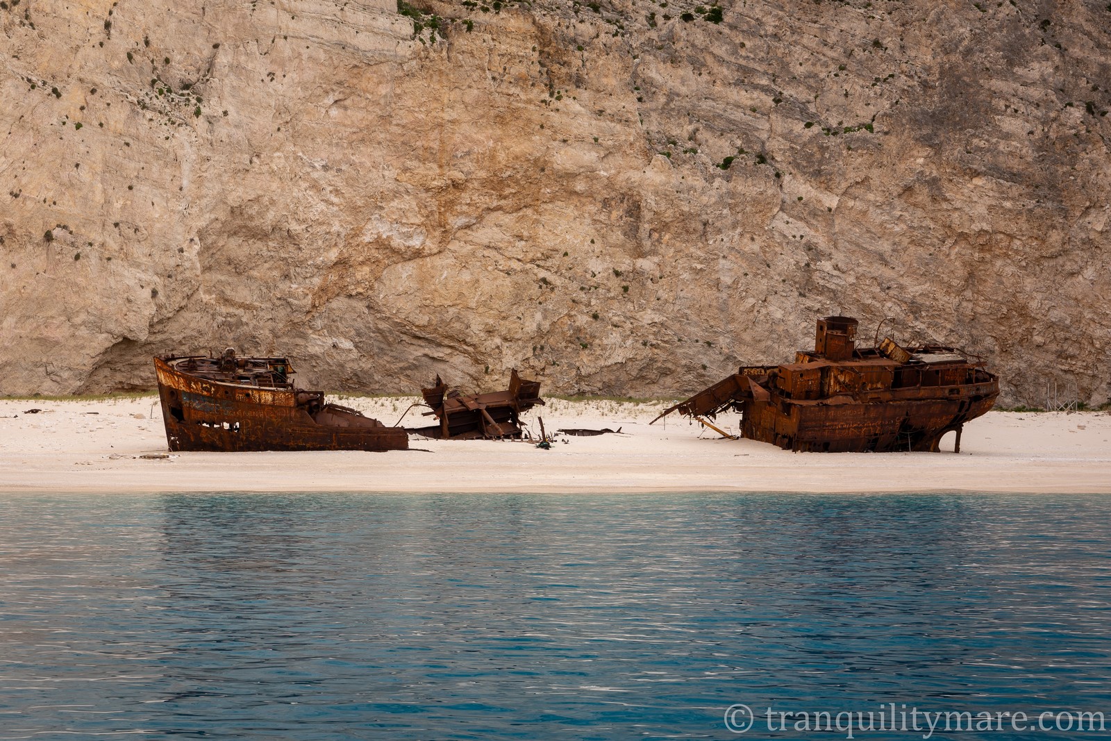
Shipwreck Beach
To be on Zakynthos and not see Shipwreck Beach is like being in Paris and not seeing the Eiffel Tower. From the start we felt the place was probably overrated. But we let ourselves be tempted by its fame and decided to go anyway. What convinced us was the thought that at this time of year there wouldn’t be any crowds, which could only make the experience better.
Shipwreck Beach – Weather Planning
We knew that stopping at Shipwreck Beach required perfectly calm weather. The bay lies on the island’s west coast and is completely open to the sea. So we waited for the right conditions – light easterly winds.
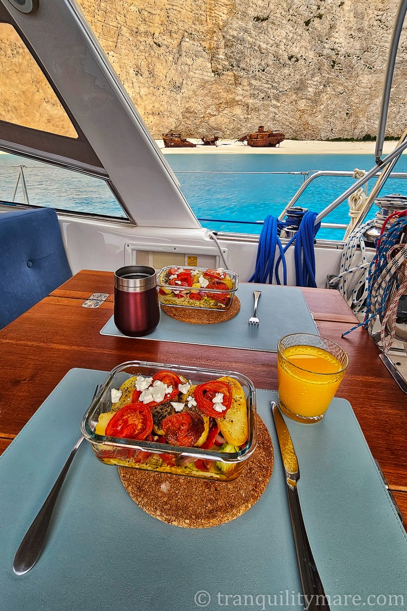
We arrived in the afternoon and we were right – we had the place entirely to ourselves. The wreck itself, though, was underwhelming. In truth, it’s now so decayed that it looks more like a pile of rusty scrap metal than a ship. Still, we had dinner overlooking the most famous beach in Greece – in complete solitude – so it’s hard to complain, isn’t it?
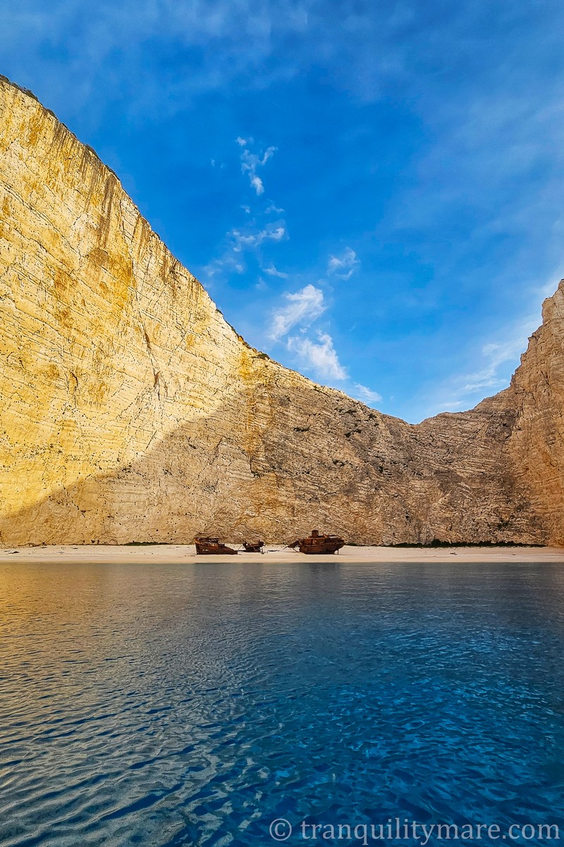
The night, however, was a completely different story. Despite the perfect forecast and light winds, sudden gusts started sweeping down from the 200-meter cliffs above us, coming from all directions. All night long we were shaken, tossed, and jolted. The anchor was well dug into the sandy seabed, but we didn’t feel safe – and sleep was out of the question. At dawn we fled the bay, angry at ourselves for giving in to an Instagram attraction. It definitely wasn’t worth it. It was the worst night at anchor in our three years of living on a yacht. Never again. The same goes for other anchorages on the west coast of Zakynthos.
Shipwreck Beach – Anchoring Ban
|
⚠️ Note: As of 2025 season, due to the risk of landslides, anchoring and going ashore at Shipwreck Beach is prohibited. You can only approach, take a photo, and leave – but trust us, you’re not missing anything. The best time is early morning or late afternoon, before the tourist boats arrive. |
In our opinion, the view is actually best enjoyed from land – from the cliffside viewpoint rather than from the water. And I can promise you this: as we continue sharing our Greek adventure, you’ll get to see far more impressive shipwrecks in other places.
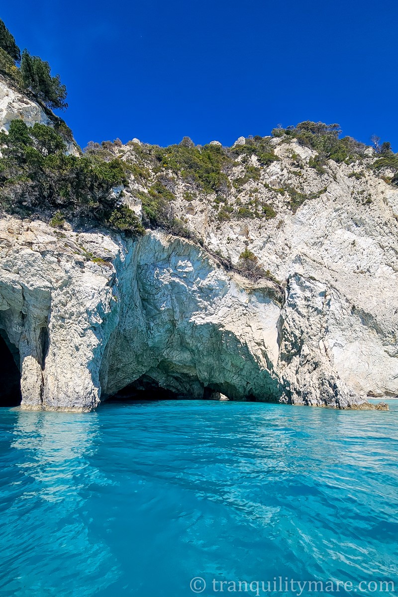
Blue Caves, Zakynthos
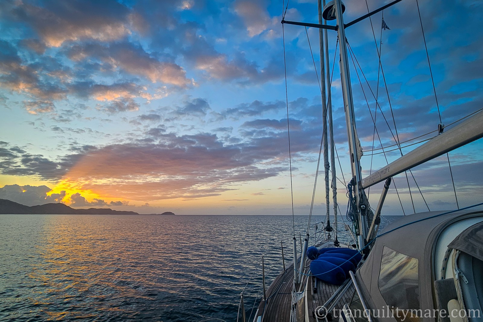
After our brief visit to Shipwreck Beach, we rounded Zakynthos to the north, hoping to stop at the Blue Caves on the northeast coast. Unfortunately, the sea state didn’t allow it, as anchoring there is only possible in very calm conditions. If you do happen to get the right weather – go for it! The snow-white cliffs reflecting the turquoise water look absolutely stunning.
We had to skip this stop, and continuing clockwise around the island, we returned to our little paradise – Gerakas Beach in the south.
Last Stop In Ionian Islands
Gerakas Bay is our final stop – both in this story and in our entire Ionian Islands cruise. I won’t write a long summary here, because both articles – the one about the Northern Ionian Islands and the one you’ve just finished reading – turned out quite extensive already. Thank you for making it to the end!
Sailing Ionian Islands – Summary
I’ll just say this: the Ionian Islands are one of the most beautiful archipelagos in the Mediterranean. They are absolutely worth spending time in. But you have to remember that they’re also extremely popular. Our main piece of advice? Avoid them at all costs in the peak season. I guarantee that outside of it they will show you their very best side.
Do you need help?
And if you need support with planning your sailing trip – whether in the Ionian Islands or anywhere else – get in touch with us. Through our sailing consultations we’ll help you organize your trip, plan the route, and provide remote support along the way.


No responses yet