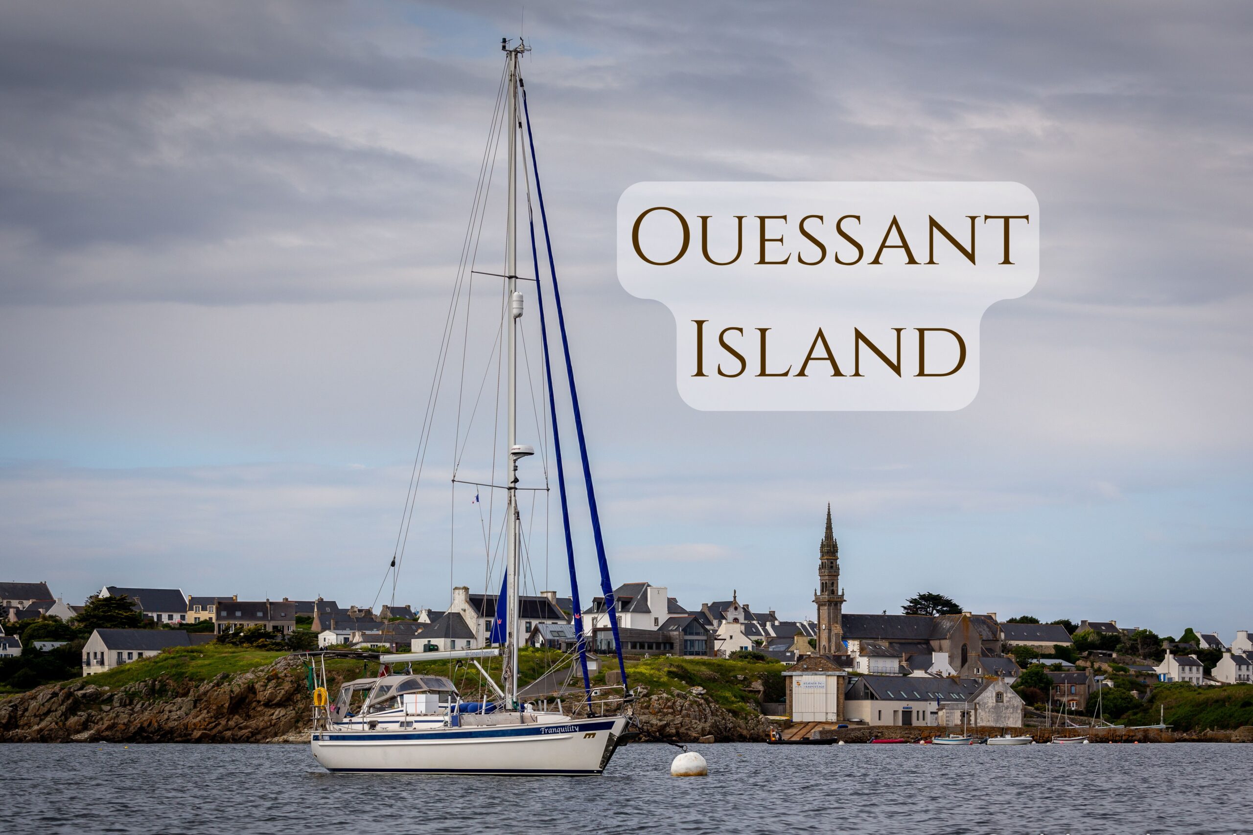
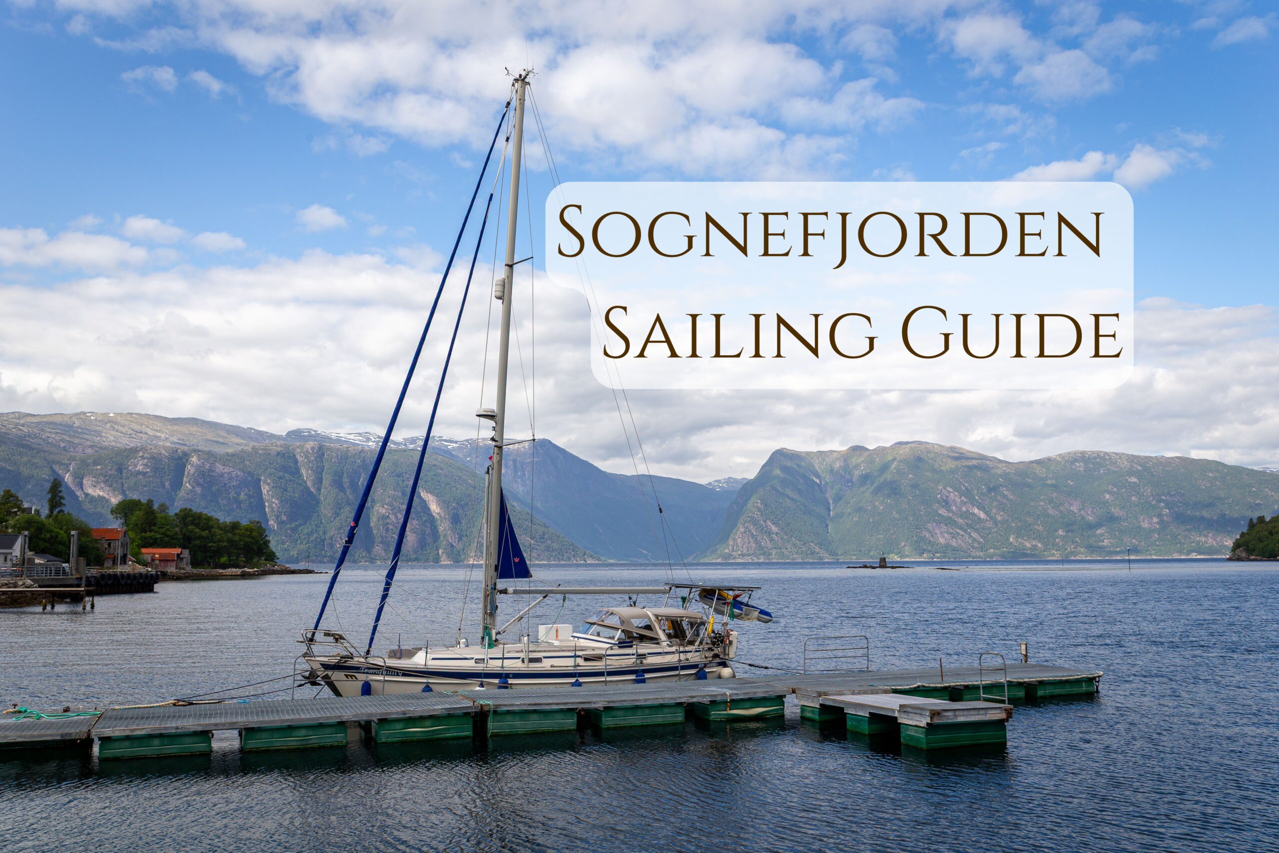
Today we’re taking you to a French island that turned out to be the perfect stopover during our northbound sail this year. After spending a few days in Brest, Brittany, we started looking for a weather window to cross the English Channel toward the British Isles. However, the forecasts were not encouraging, and the prospect of spending more days in a rather uncharming city wasn’t very appealing. So instead of waiting idly, we decided to sail to Île d’Ouessant — an island that not only added charm to our route but also allowed us to shorten the crossing to Britain just a bit.
Ile d’Ouessant (Ushant) – General Info
Ouessant Island, known in English as Ushant, is a rugged and windy island located off the western tip of Brittany in northwestern France, part of the Molène archipelago. It is the westernmost point of mainland France and plays a crucial role in maritime navigation, marking the boundary between the English Channel and the Atlantic Ocean. Covering about 15 km², it’s significantly larger than the other nearby islands such as Molène (around 0.75 km²) or Île de Sein (around 0.58 km²). Ouessant is also the most important navigational point in the archipelago thanks to its powerful lighthouses.
Ushant – Sailors’ Landmark
For centuries, Ouessant (Ushant) has been a key navigational landmark for British sailors — the last bit of land seen before returning home from long and perilous sea voyages. When mariners passed this archipelago, they knew they’d be setting foot on British soil the very next day. The island is even mentioned in the sea shanty “Spanish Ladies”, in which they sing:
“We’ll rant and we’ll roar, like true British sailors, we’ll range and we’ll roam over all the salt seas… until we strike soundings in the Channel of old England; from Ushant to Scilly is thirty-five leagues.”
For old-time sailors, “from Ushant to Scilly” meant familiar waters and the beginning of a safe passage home.
In the 20th and 21st centuries, the island gained special significance in round-the-world yacht racing: since the establishment of the start line for one of the most prestigious maritime challenges — the Jules Verne Trophy — Ushant has symbolized the starting and finishing point of a global circumnavigation. As they approach Ushant, skippers look out for the light of the Créac’h lighthouse, knowing that beyond it lie familiar waters, home, and well-earned rest.
Ile d’Ouessant Navigational Challenges
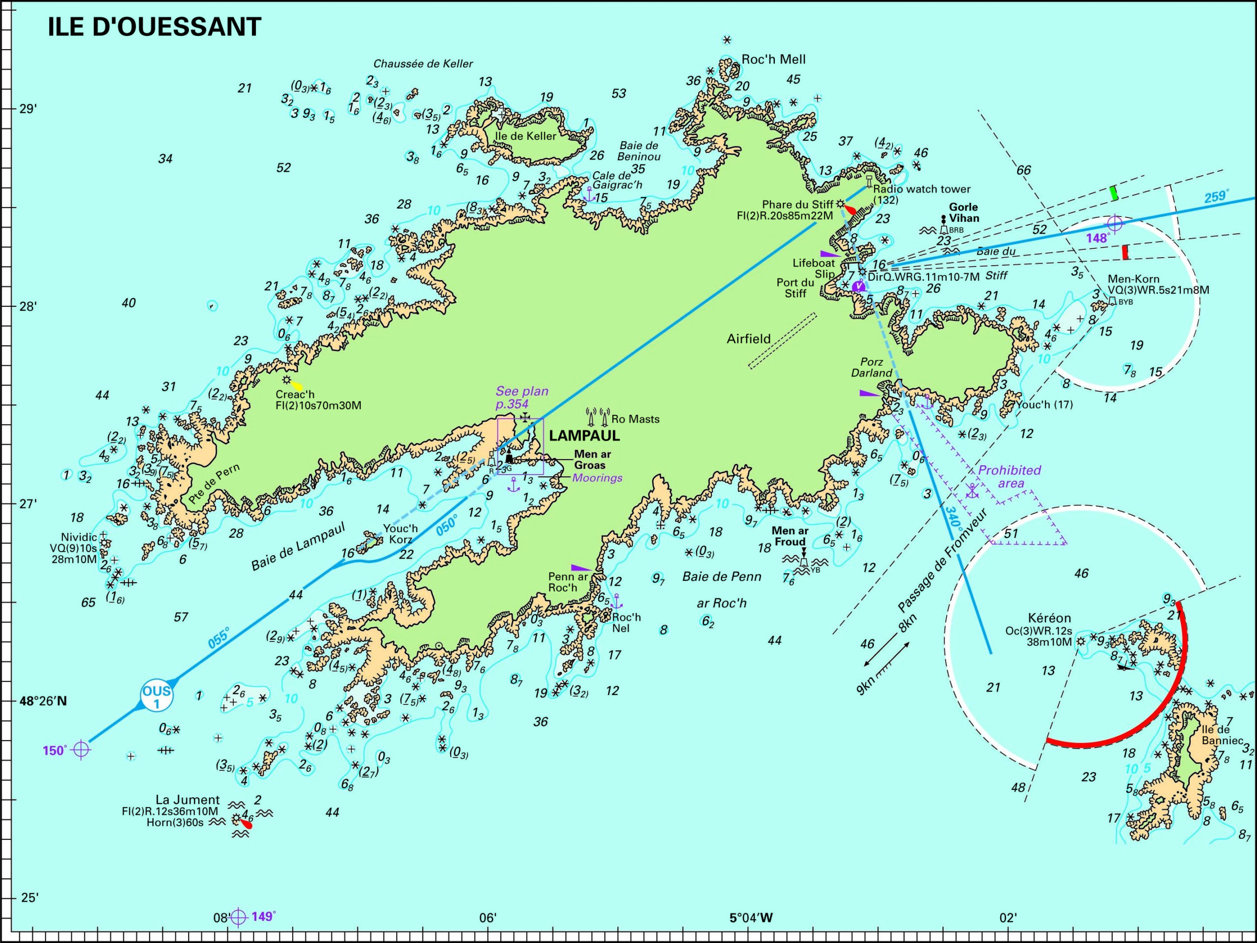
Sailing between mainland France and these westernmost islands is no easy feat. The three channels — Fromveur, Helle, and Chenal du Four — are notorious for their exceptionally strong currents, which can reach up to 9 knots during spring tides. Add to this a rocky, jagged coastline (where many a vessel has found trouble), unpredictable Atlantic weather, ocean swell, and frequent fog, and it’s easy to see why most yachts sailing from northern Europe to the south (and back) avoid these unwelcoming islands.
Ushant by Yacht: Preparation Is Everything
But if you do decide to visit Île d’Ouessant by yacht or plan to sail through these nearby straits, thorough preparation is essential. The most reliable source of information will, of course, be the current nautical almanac, where you’ll find not only tide tables but, more importantly, detailed descriptions of each channel — including current directions and strength, areas to avoid, headlands which waters round and guidance on safe navigation in the region. It’s a wealth of knowledge we won’t reprint here — we assume every sailor has an almanac and knows how to use it. But if you need support planning your passage through these waters, feel free to contact us — as part of our consulting services, we offer personalized assistance in such a route planning.
Mooring options at Ile d’Ouessant
As I mentioned, we aimed for Île d’Ouessant — the largest island in the archipelago — although anchorages can be found off the smaller islands too. However, none of them have a marina or dock where a yacht can tie up. Finding a suitable, sheltered anchorage therefore requires careful planning — not only considering wind direction and currents but also the Atlantic swell, which can turn an otherwise pleasant anchorage into a sleepless night and make it impossible to land ashore.
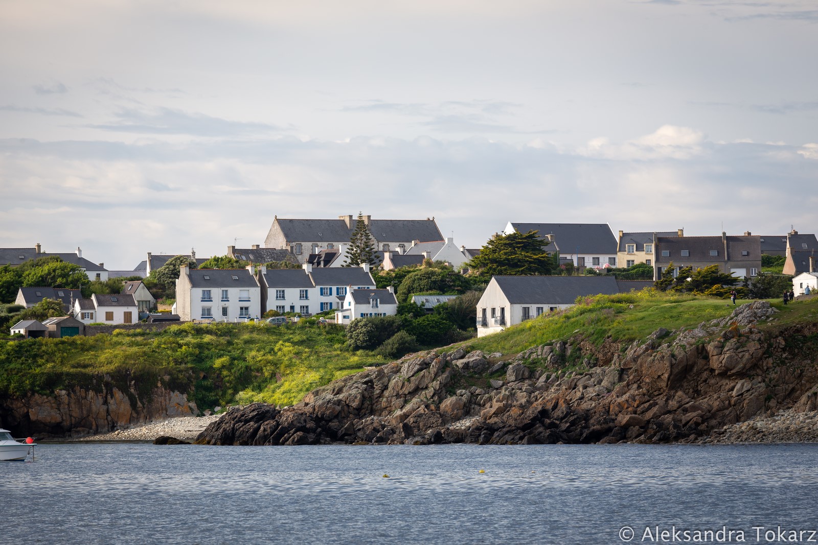
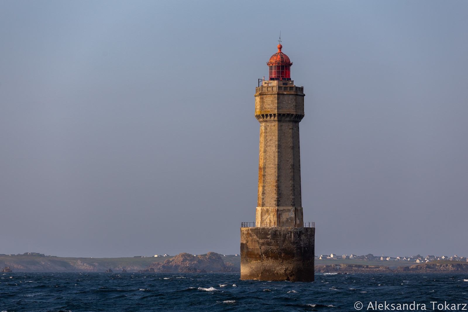
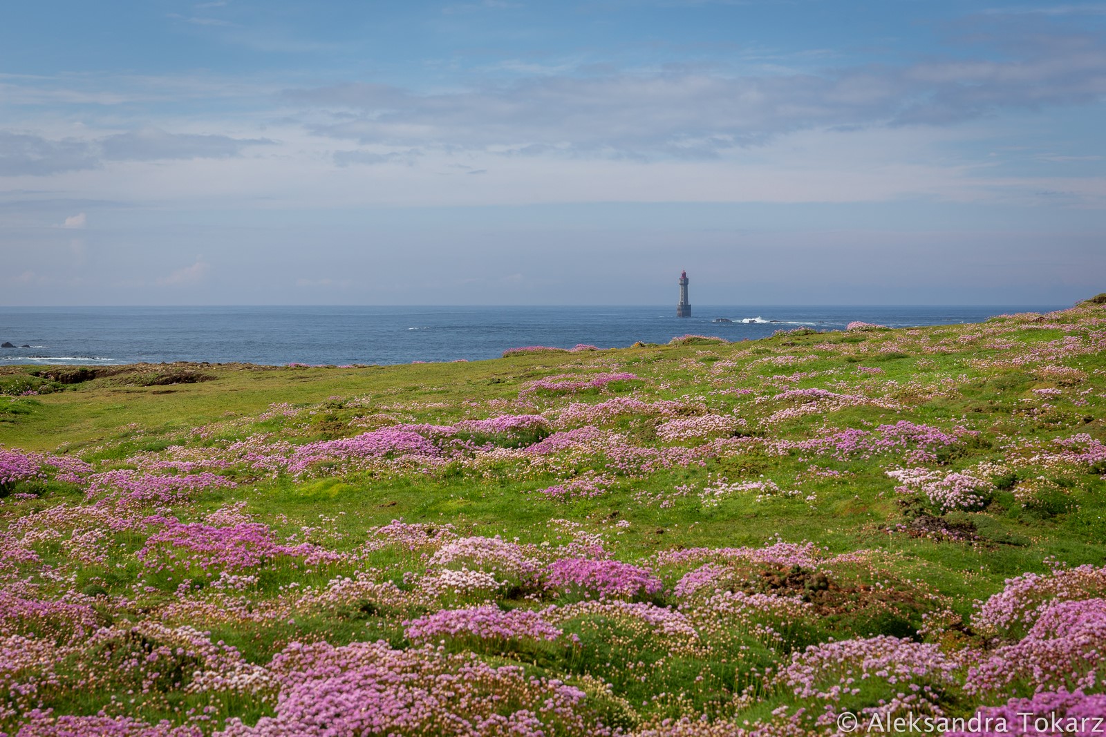
It’s fair to say that the most popular anchorage in the entire archipelago is the bay near the town of Lampaul on Île d’Ouessant. It’s the spot most visiting yachts choose — and so did we. When approaching the bay, be mindful of the strong currents in the Fromveur Strait — the strongest in the archipelago. Combined with numerous rocks, they can create very turbulent seas around the southern tip of the island, near the famous Le Jument lighthouse. It’s definitely best to give that cape a wide berth rather than trying to cut across directly to the bay.
Le Jument Lighthouse
Planning the passage already gives you a glimpse of the island’s fascinating maritime history. As you approach the shore, the coastline dotted with lighthouses and navigational lights is immediately striking. This coastline is notoriously difficult to navigate — in the days before accurate maps and GPS, it claimed countless ships and lives. Yet every shipwreck left something of value: knowledge for future mariners and a push to mark the most dangerous places, which eventually improved safety significantly.
Construction of Le Jument
Just off Ouessant lies one of the most famous lighthouses in the world — Le Jument. Built on a rock about 300 meters from the island, it was a response to numerous shipwrecks in the area. Between 1888 and 1904, 31 ships were lost there, including the particularly tragic sinking of the steamship SS Drummond Castle, which claimed 250 lives. Plans to build the lighthouse began soon after this disaster. Construction started in 1904, funded by a French businessman who had nearly lost his own life on the rocks off the island. The lighthouse became operational in 1911, but due to harsh conditions and its exposed location, it has undergone numerous repairs to prevent collapse.
Le Jument and Famous Photograph
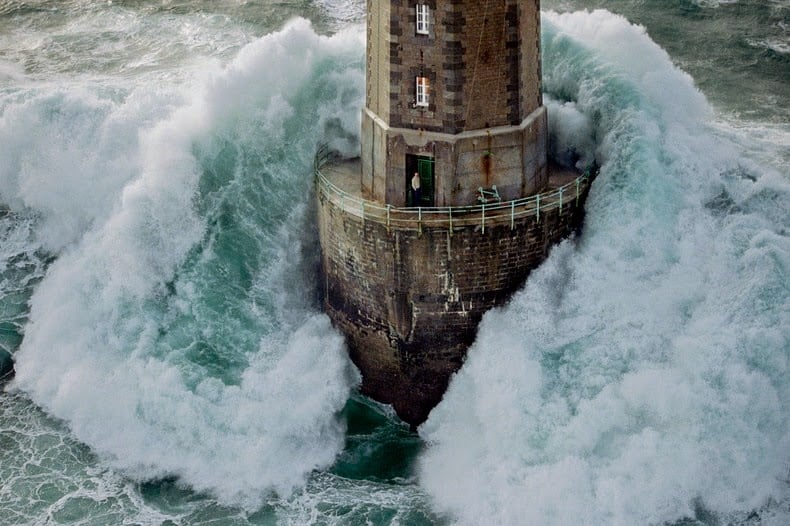
Although that story is compelling, it’s not entirely different from other remote lighthouse tales. So what made Le Jument world-famous? Not its construction. Fame came much later, during one of the worst storms in the Atlantic, on December 21, 1989. A deep low pressure system from Ireland brought hurricane-force winds and waves 20–30 meters high that slammed into Le Jument. The waves shattered the lower windows, tore off the entrance doors, and flooded the tower, destroying its interior.
At the same time, photographer Jean Guichard chartered a helicopter in Lorient to shoot the storm from the air despite the dangerous conditions. As the helicopter neared the lighthouse, the keeper, Malgorn, heard the noise and stepped outside to see what was happening. At that moment, a massive wave struck the back of the lighthouse, and Guichard captured the now-iconic image that became a symbol of nature’s power. Malgorn dashed back inside just in time, saving his life. Guichard’s photo won second place in the 1991 World Press Photo contest and Le Jument became one of the most recognized lighthouse images in the world.
In the years since, Brittany’s lighthouses have been automated, and Le Jument has had no keeper since 1991.
Sailing past this iconic lighthouse today — in an era of GPS, electronic charts, accurate forecasts, and all sorts of modern comforts — it’s hard to imagine what sailors went through in earlier centuries. All that remains is to admire this architectural marvel, still standing proudly among the Atlantic waves, still guiding mariners to safety.
Lampaul Bay, Ile d’Ouessant
Anchorage and mooring buoys in Lampaul Bay
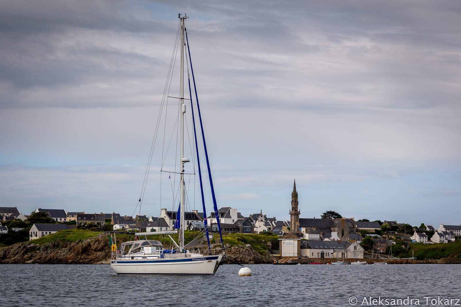
The large bay near Lampaul offers very good shelter from northeastern through north to northwestern winds. With southerly winds or during calm conditions, Atlantic swell can enter the bay, making anchoring uncomfortable and shore landings by dinghy tricky. A solution might be to deploy a second anchor from the stern to keep the boat bow-on to the swell, though depth is a challenge. The bay has several white mooring buoys for visiting yachts, which are free of charge. Anchoring is possible south of the buoys, in depths over 15 meters. During the long May weekend, all the buoys were occupied by evening, so we spent our first night at anchor. Our anchor held on the first try, but from other sailors’ reports, it can take several attempts in some spots. After the busy weekend, most buoys were free again, and we moved closer to shore.
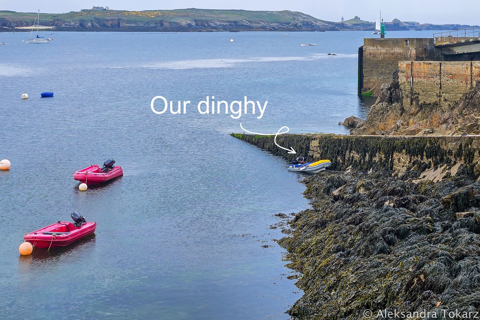
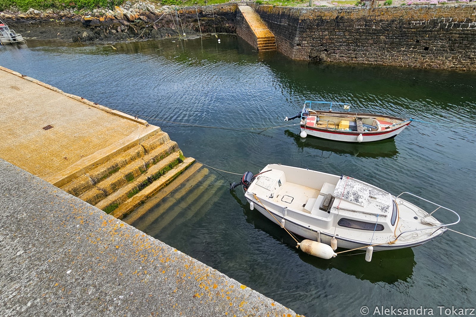
Dinghy docks in Lampaul, Ile d’Ouessant
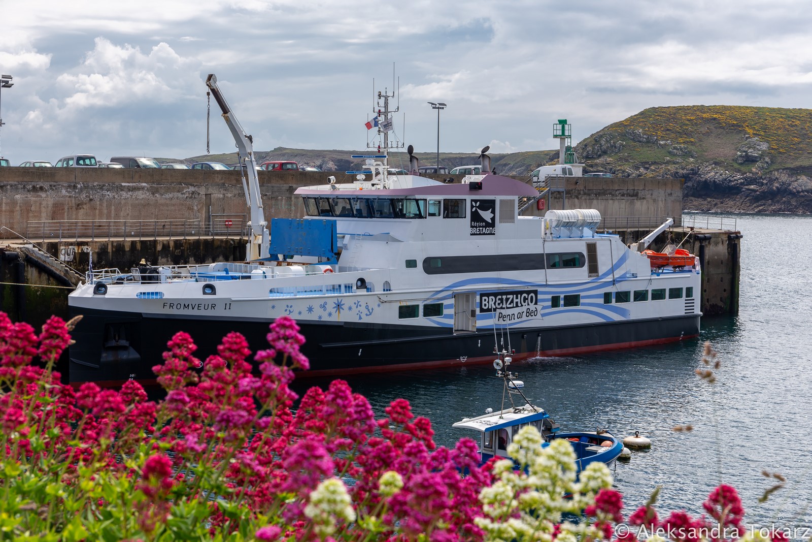
Lampaul has a small tidal fishing harbor. Dinghies can be left in three places: along the long quay west of the harbor entrance (you’ll need a ladder), on the slipway in front of the port, or inside the harbor at the inner quay, accessible only at high tide (with steps for coming ashore). For us, the slipway worked best — we left the dinghy there every time, tied with a mooring line adjusted to the tide.
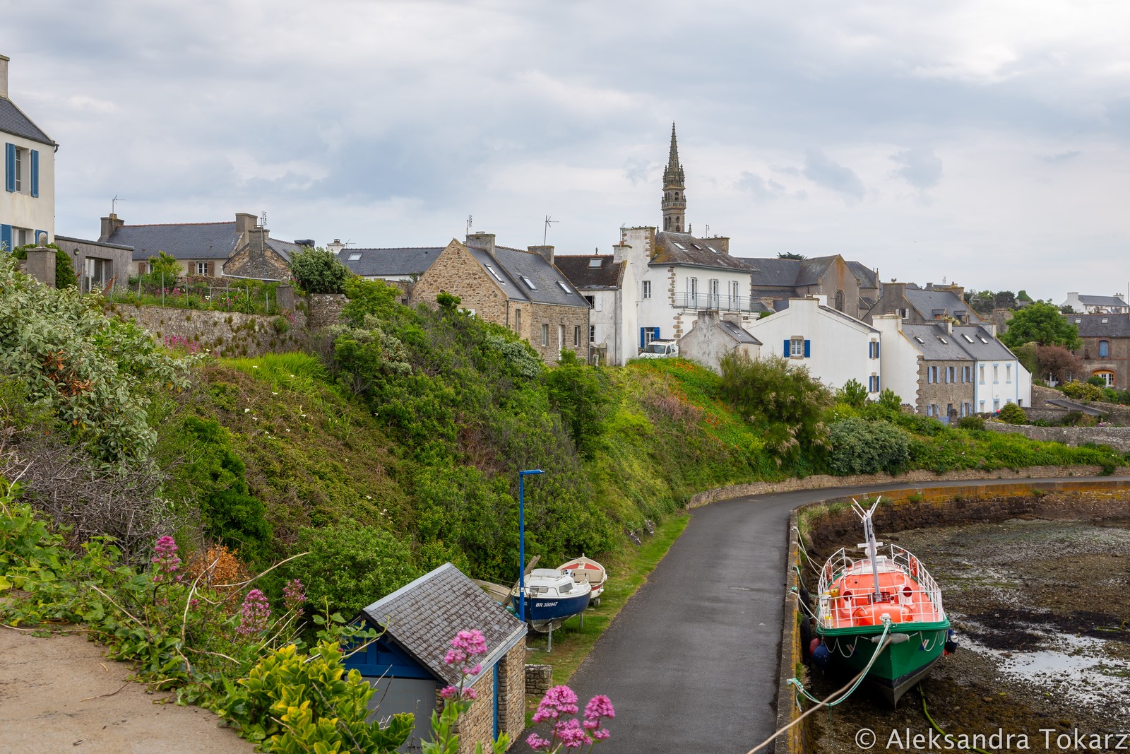
Visiting Lampaul Town
From the port, it’s just a few minutes’ walk to Lampaul town, where you’ll find a few cafés, restaurants, and souvenir shops. Seasonal crepe stands open too, and in the morning you can buy fresh fish nearby. The town turned out to be more touristy than expected, thanks to easy access from mainland France — ferries and small planes service Ouessant.
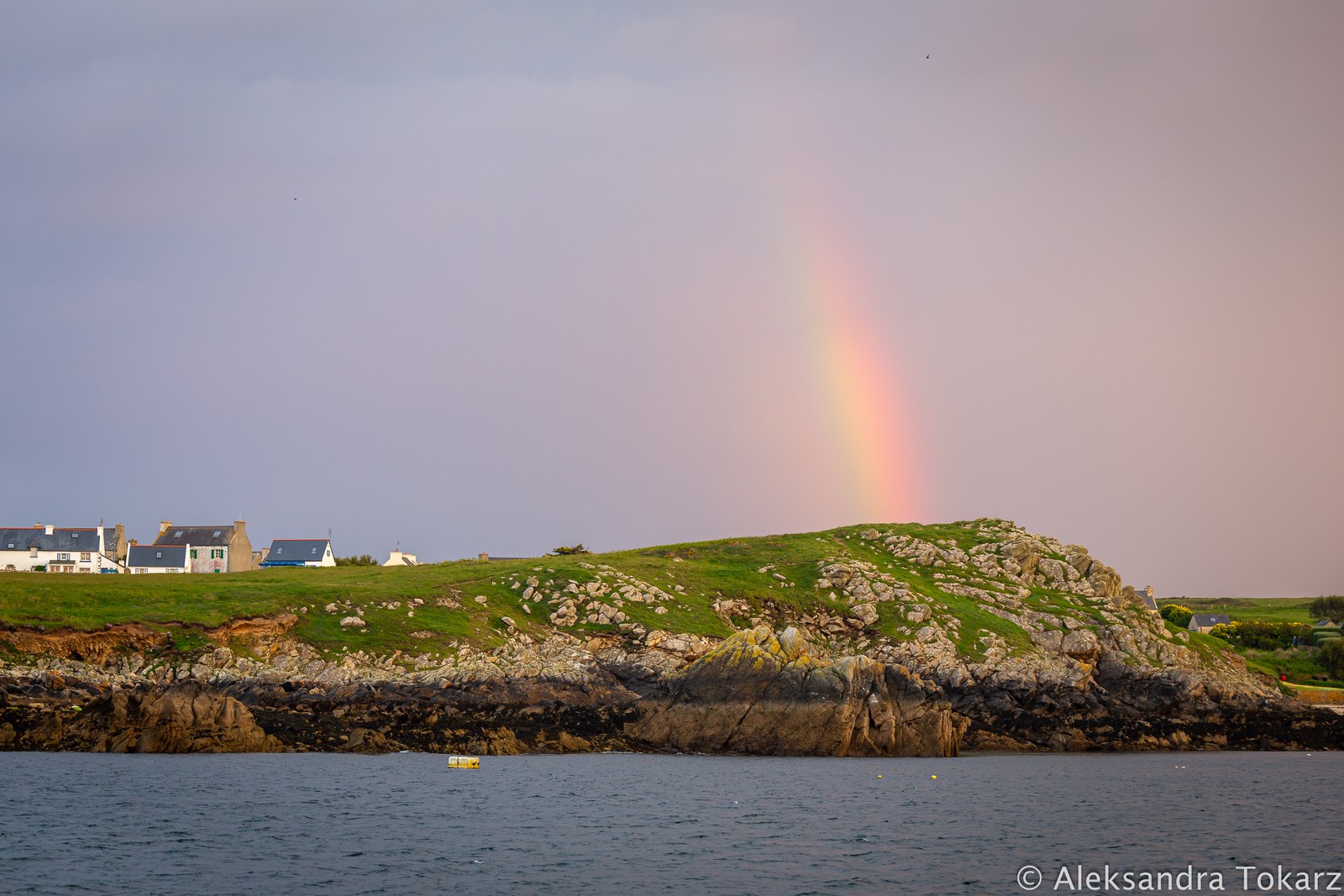
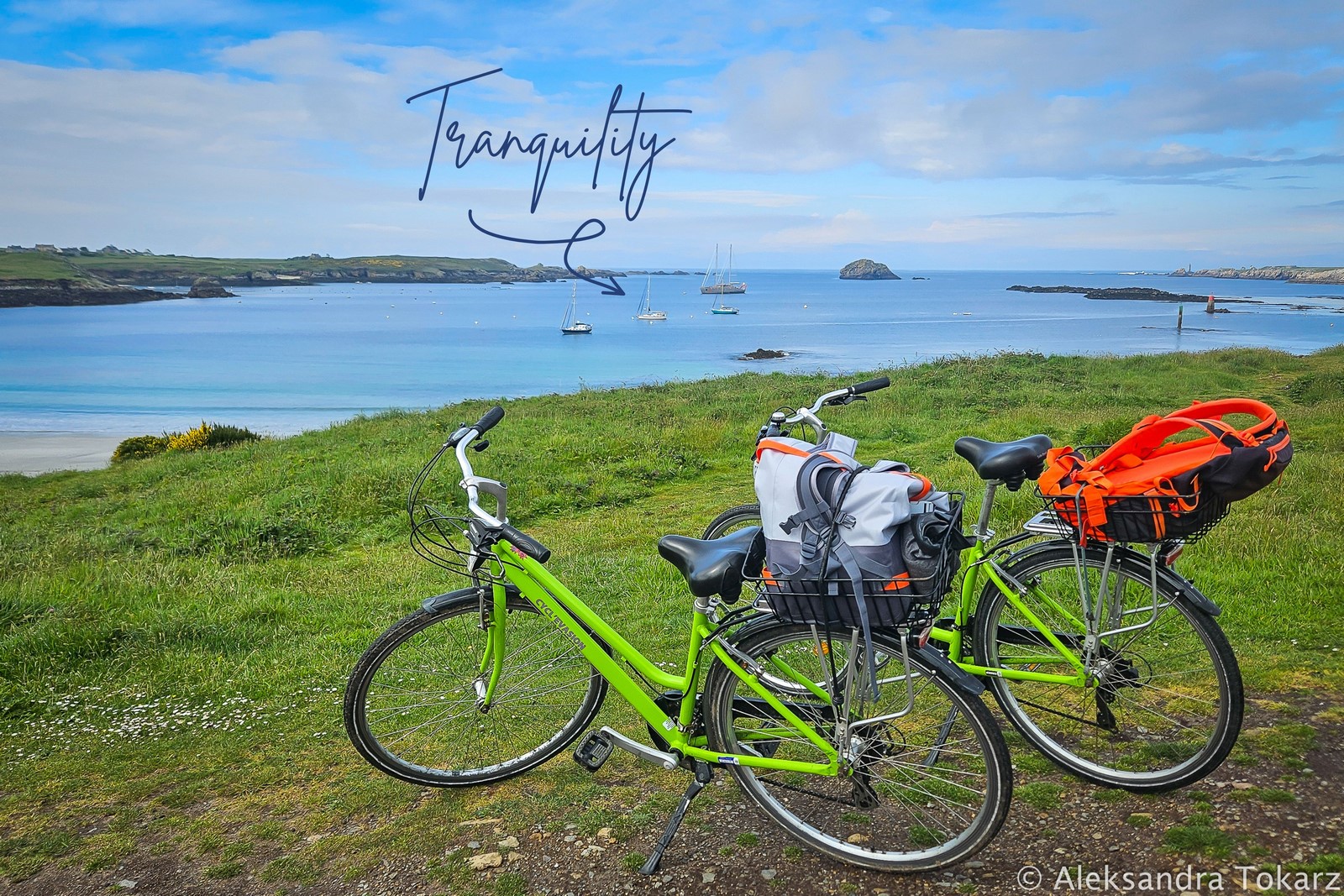
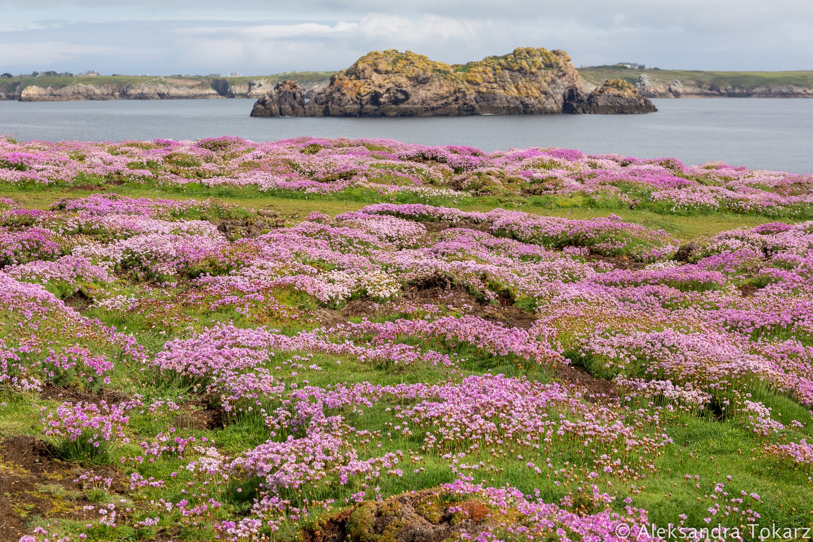
The main attraction of the island, and the primary means of transport, is the bicycle. While biking isn’t my favorite way to explore (mostly because it’s hard to combine cycling with photography), it’s hard to resist a bike ride along Ouessant’s winding rural roads leading to dramatic coastal cliffs lined with wildflowers. This time of year, the scenery is stunning — blue ocean, green hills, and pink wildflowers create a surreal landscape. And while I’m sure it’s beautiful year-round, I have a feeling that spring is the very best time to visit.
Ile d’Ouessant Picturesque Walks
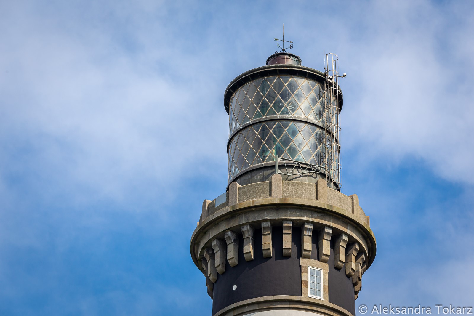
Before hopping on bikes, we took a long walk to one of the island’s most extraordinary lighthouses — Créac’h. It’s one of the most powerful lighthouses in the world, visible from over 37 NM away. First lit in 1863, it still plays a vital role in navigation at the edge of the Channel and Atlantic. Right next to it is the Maritime Lighthouse Museum, which unfortunately (as of 2025) was closed for renovations and expansion. Once reopened, it’s sure to be one of Ouessant’s highlights.
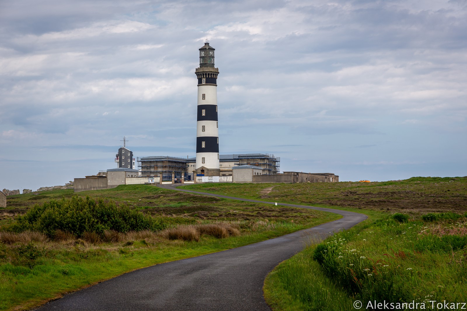
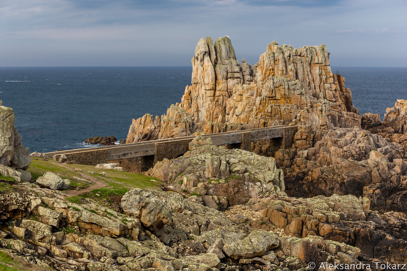
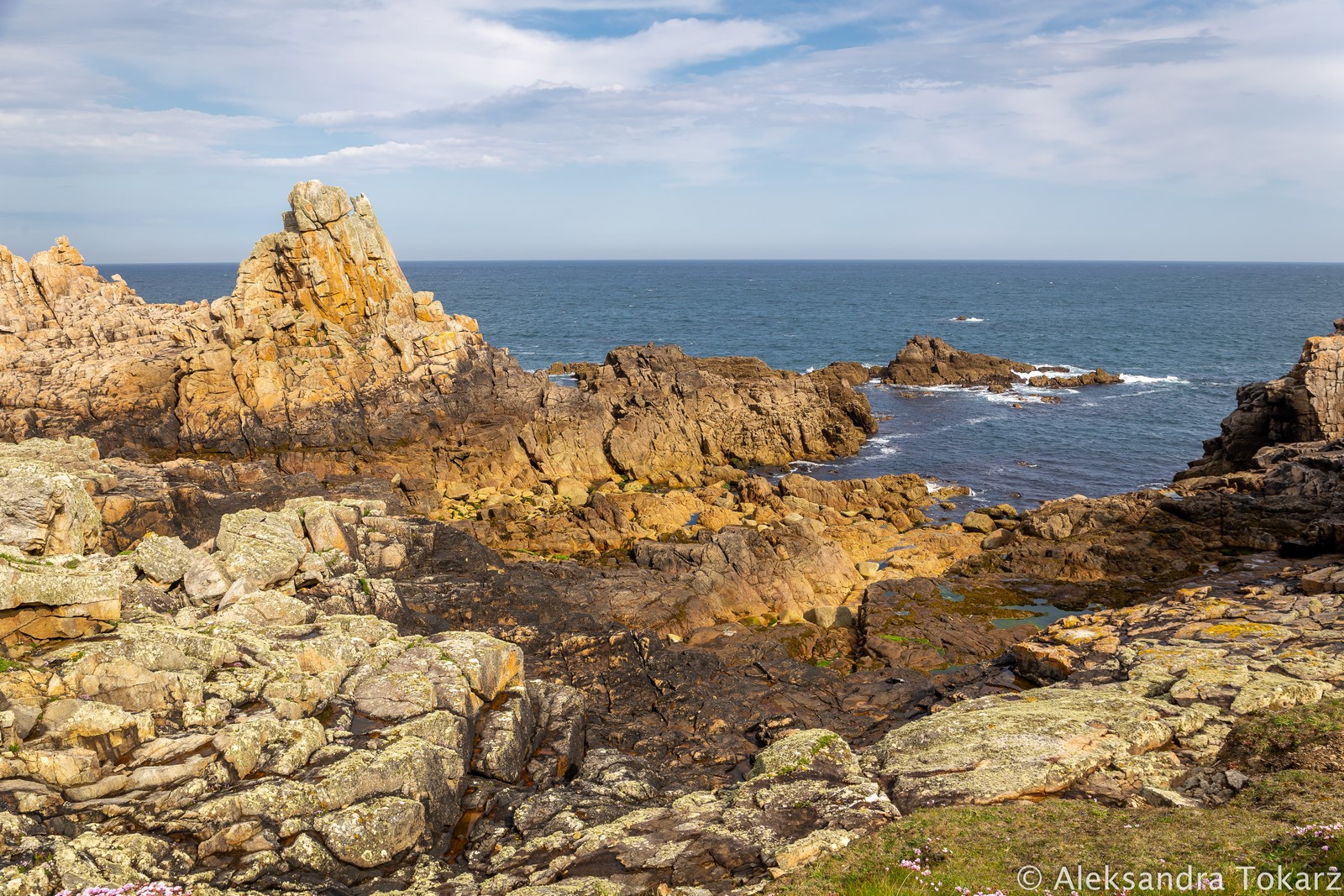
Behind the lighthouse stretches a dramatic, rocky coastline shaped by Atlantic storms — forming jaw-dropping rock formations. If you’re only on Ouessant for a short time, this is the walk (about 2.5 km one way, on foot or by bike) we recommend most.
Ile d’Ouessant by Bike
We were lucky with the weather and got to stay a bit longer, so the next day we rented bikes from this rental place (around €14 per day, as of 2025), although there are several others on the island. This time we headed to the south and east coasts, where wildflowers and green hills stole the show again. We caught another glimpse of the famous Le Jument lighthouse and could watch the massive volume of water flowing through the channels during strong tidal currents.
Le Stiff – Anchorage on the NE side
We passed the airstrip and reached the opposite shore at Le Stiff, where the ferry dock and a small anchorage with a few mooring buoys are located. This spot is best sheltered from southwest and west winds. You can also anchor in deeper water here, although some areas have a rocky seabed.
We returned to Lampaul via the island’s north side, accompanied frequently by sheep. On Ouessant, farming has always been the main livelihood since the dangerous surrounding waters never allowed a large fishing industry to develop.
Visiting Ile d’Ouessant by Sail – Summary
Instead of waiting for a weather window in Brest, we sailed to the wild and beautiful Ouessant — an island that turned out to be not only a fascinating place full of history, but also an excellent stop on our Channel crossing. Challenging for navigation, but absolutely unique. The weather was kind, so we had the chance to explore on foot and by bike. In spring, this island is truly magical — wildflowers, steep cliffs, and iconic lighthouses. A place well worth visiting, despite the logistical and navigational challenges.
If, like us, the archipelago is just a stopover on your journey, we recommend choosing Ouessant. If conditions allow, the bay near Lampaul is the best base for exploring the island. Alternatively, there are mooring buoys in Le Stiff on the island’s eastern shore, near the ferry dock. If you don’t have much time, opt for a short walk or bike ride to Créac’h lighthouse and enjoy the surrounding rocky coastline. If you have more time — nothing’s stopping you from exploring the island far and wide!


No responses yet